Soubor:Turgot map Paris KU 04.jpg

Velikost tohoto náhledu: 800 × 483 pixelů. Jiná rozlišení: 320 × 193 pixelů | 640 × 387 pixelů | 1 024 × 619 pixelů | 1 280 × 773 pixelů | 2 560 × 1 547 pixelů | 4 800 × 2 900 pixelů.
Původní soubor (4 800 × 2 900 pixelů, velikost souboru: 4,56 MB, MIME typ: image/jpeg)
| Tento soubor pochází z Wikimedia Commons. Níže jsou zobrazeny informace, které obsahuje jeho tamější stránka s popisem souboru. |
Popis
| Popis |
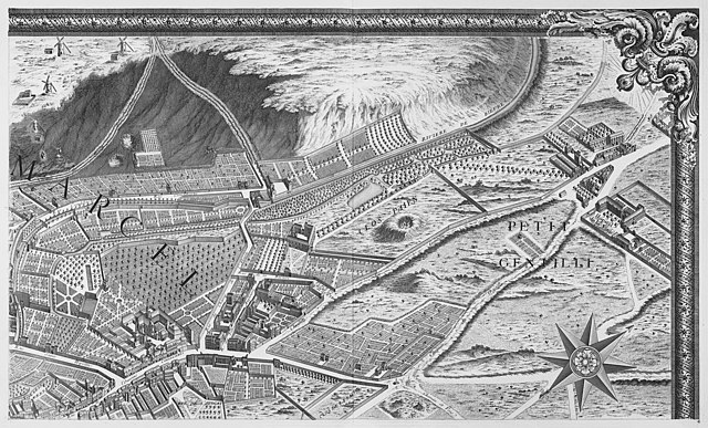
English: Plate 4 of the Turgot map of Paris |
||||||||||||||||||||||||||||||||||||||
| Datum | (publication) | ||||||||||||||||||||||||||||||||||||||
| Zdroj | Kyoto University Library | ||||||||||||||||||||||||||||||||||||||
| Autor |
Kartograf :
Rytec :
|
||||||||||||||||||||||||||||||||||||||
| Další verze | Turgot map of Paris, Kyoto University Library | ||||||||||||||||||||||||||||||||||||||
|
Licence
|
Toto dílo je volné také v zemích, jejichž právní řád chrání majetková autorská práva po dobu života autora a 100 let po jeho smrti. | |
| Bylo zjištěno, že u tohoto souboru nejsou známa žádná omezení daná autorským právem a právy s ním souvisejícími. | |
| Poznámky | K tomuto souboru existují poznámky: Prohlédnout si poznámky na Commons |
Historie souboru
Kliknutím na datum a čas se zobrazí tehdejší verze souboru.
| Datum a čas | Náhled | Rozměry | Uživatel | Komentář | |
|---|---|---|---|---|---|
| současná | 22. 9. 2015, 15:59 | | 4 800 × 2 900 (4,56 MB) | Paris 16 | resize |
| 5. 3. 2011, 10:11 |  | 4 866 × 2 990 (5,77 MB) | Robert.Allen | {{Information |Description ={{en|1=Plate 4 of the Turgot map of Paris}} |Source =http://edb.kulib.kyoto-u.ac.jp/exhibit-e/f28/image/01/f28s0007.html |Author =Louis Bretez, cartographer; Claude Lucas, engraver |
Využití souboru
Tento soubor používá následující stránka: