Soubor:Hvo controlled.png
Původní soubor (1 220 × 1 100 pixelů, velikost souboru: 99 KB, MIME typ: image/png)
| Tento soubor pochází z Wikimedia Commons. Níže jsou zobrazeny informace, které obsahuje jeho tamější stránka s popisem souboru. |
Popis
(
| Popis |
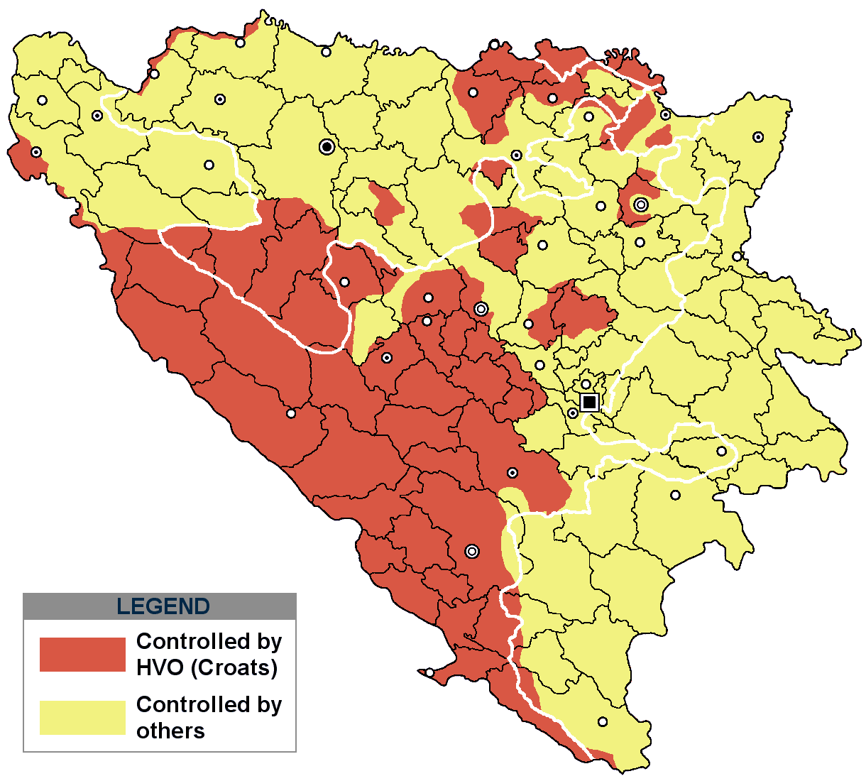
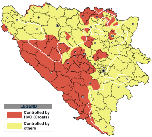
This is an update for the previous map, as the HVO never controlled all parts of municipality of Mostar and Stolac. Also, HVO never controlled neither part of municipalities Nevesinje, Berkovići, Ljubinje and Trebinje.
|
| Datum | |
| Zdroj | self-made by Nihad Hamzić |
| Autor | Nihad Hamzic |
}
Licence
| I, Nihad Hamzic, autor tohoto díla, jej uvolnil jako volné dílo, a to celosvětově. V některých zemích to není podle zákona možné; v takovém případě: I, Nihad Hamzic poskytuje komukoli právo užívat toto dílo za libovolným účelem, a to bezpodmínečně s výjimkou podmínek vyžadovaných zákonem. |
The original image is here:
http://commons.wikimedia.org/wiki/Image:Hvo_controled.GIF
Check its description for licensing etc.
Historie souboru
Kliknutím na datum a čas se zobrazí tehdejší verze souboru.
| Datum a čas | Náhled | Rozměry | Uživatel | Komentář | |
|---|---|---|---|---|---|
| současná | 29. 11. 2020, 19:21 | | 1 220 × 1 100 (99 KB) | Ceha | Tuzla i Bugojno |
| 28. 11. 2020, 15:31 |  | 1 220 × 1 100 (98 KB) | Ceha | Dodao neke promjene, od Ravne-Brčko, do Ravnog na jugu (operacija Bura https://hr.wikipedia.org/wiki/Operacija_Bura ) | |
| 20. 7. 2011, 19:40 |  | 1 220 × 1 100 (48 KB) | DIREKTOR | Colors | |
| 11. 2. 2009, 11:29 |  | 1 220 × 1 100 (49 KB) | Ceha | Corrected errors in Komušina municipality, HVO controled all of Croatian settlments till 10th of August 1991 | |
| 11. 8. 2008, 10:24 |  | 1 220 × 1 100 (49 KB) | Mostarac | {{Information |Description=This is an update for the previous map, as the HVO never controlled all parts of municipality of Mostar and Stolac. Also, HVO never controlled neither part of municipalities Nevesinje, Berkovići and Ljubinje. |Source=self-made | |
| 5. 1. 2008, 16:33 |  | 1 220 × 1 100 (49 KB) | Nihad Hamzic | Added a legend. Also widened the image slightly to match the size of related images. I did not resize it, but added white space at sides. | |
| 17. 7. 2007, 12:08 |  | 1 213 × 1 100 (41 KB) | Nihad Hamzic | Revised the colors to match (to be uniform) with colors in other related maps. | |
| 16. 7. 2007, 00:31 |  | 1 213 × 1 100 (41 KB) | Nihad Hamzic | {{Information |Description=BiH territories which were controlled by HVO and regular Croatian Army for some time during the war. <br /> <br /> NOTICE:<br /> This image is a greatly optimised PNG version of the original GIF version of the image. Color dihte |
Využití souboru
Tento soubor používá následující stránka:
Globální využití souboru
Tento soubor využívají následující wiki:
- Využití na ar.wikipedia.org
- Využití na ast.wikipedia.org
- Využití na bs.wikipedia.org
- Využití na ca.wikipedia.org
- Využití na de.wikipedia.org
- Využití na es.wikipedia.org
- Využití na eu.wikipedia.org
- Využití na fr.wikipedia.org
- Využití na gl.wikipedia.org
- Využití na hy.wikipedia.org
- Využití na hyw.wikipedia.org
- Využití na it.wikipedia.org
- Využití na pnb.wikipedia.org
- Využití na pt.wikipedia.org
- Využití na ru.wikipedia.org
- Využití na sr.wikipedia.org
- Využití na sv.wikipedia.org
- Využití na vi.wikipedia.org