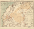
Soubor:Western Sahara 1876.png

Velikost tohoto náhledu: 698 × 600 pixelů. Jiná rozlišení: 279 × 240 pixelů | 559 × 480 pixelů | 746 × 641 pixelů.
Původní soubor (746 × 641 pixelů, velikost souboru: 882 KB, MIME typ: image/png)
Historie souboru
Kliknutím na datum a čas se zobrazí tehdejší verze souboru.
| Datum a čas | Náhled | Rozměry | Uživatel | Komentář | |
|---|---|---|---|---|---|
| současná | 4. 3. 2017, 10:36 |  | 746 × 641 (882 KB) | Koavf | whitespace |
| 4. 3. 2017, 01:42 |  | 1 366 × 641 (953 KB) | Kenzahurts | User created page with UploadWizard |
Využití souboru
Tento soubor používá následující stránka:
Globální využití souboru
Tento soubor využívají následující wiki:
- Využití na ar.wikipedia.org
- Využití na ca.wikipedia.org
- Využití na en.wikipedia.org
- Využití na eo.wikipedia.org
- Využití na es.wikipedia.org
- Využití na it.wikipedia.org
- Využití na ja.wikipedia.org
- Využití na pt.wikipedia.org
- Využití na ru.wikipedia.org
- Využití na te.wikipedia.org
- Využití na th.wikipedia.org
- Využití na uk.wikipedia.org
- Využití na zh.wikipedia.org