Soubor:The River Moy at Foxford - geograph.org.uk - 486800.jpg
Větší rozlišení není k dispozici
The_River_Moy_at_Foxford_-_geograph.org.uk_-_486800.jpg (640 × 396 pixelů, velikost souboru: 104 KB, MIME typ: image/jpeg)
| Tento soubor pochází z Wikimedia Commons. Níže jsou zobrazeny informace, které obsahuje jeho tamější stránka s popisem souboru. |
Popis
| Popis |
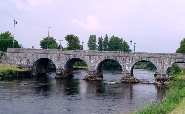
English: The River Moy at Foxford Marks on the pillars of the bridge show the height of the river water before the channel was deepened 40 years ago to alleviate flooding. The water used to cover the bank and path at the bottom right of the picture |
| Datum | |
| Zdroj | From geograph.org.uk |
| Autor | Liz McCabe |
| Uveďte autora (vyžadováno licencí) | Liz McCabe / The River Moy at Foxford / |
| Pozice fotografa | | Tento snímek a mnohé další na: OpenStreetMap |
|---|
_heading:0.00&language=cs)
| Pozice objektu | | Tento snímek a mnohé další na: OpenStreetMap |
|---|
_heading:0.00&language=cs)
Licence

|
This image was taken from the Geograph project collection. See this photograph's page on the Geograph website for the photographer's contact details. The copyright on this image is owned by Liz McCabe and is licensed for reuse under the Creative Commons Attribution-ShareAlike 2.0 license.
|
Tento soubor podléhá licenci Creative Commons Uveďte autora-Zachovejte licenci 2.0 Generic
Uveďte autora: Liz McCabe
- Dílo smíte:
- šířit – kopírovat, distribuovat a sdělovat veřejnosti
- upravovat – pozměňovat, doplňovat, využívat celé nebo částečně v jiných dílech
- Za těchto podmínek:
- uveďte autora – Máte povinnost uvést autorství, poskytnout odkaz na licenci a uvést, pokud jste provedli změny. Toho můžete docílit jakýmkoli rozumným způsobem, avšak ne způsobem naznačujícím, že by poskytovatel licence schvaloval nebo podporoval vás nebo vaše užití díla.
- zachovejte licenci – Pokud tento materiál jakkoliv upravíte, přepracujete nebo použijete ve svém díle, musíte své příspěvky šířit pod stejnou nebo slučitelnou licencí jako originál.
Historie souboru
Kliknutím na datum a čas se zobrazí tehdejší verze souboru.
| Datum a čas | Náhled | Rozměry | Uživatel | Komentář | |
|---|---|---|---|---|---|
| současná | 5. 2. 2011, 04:57 | | 640 × 396 (104 KB) | GeographBot | == {{int:filedesc}} == {{Information |description={{en|1=The River Moy at Foxford Marks on the pillars of the bridge show the height of the river water before the channel was deepened 40 years ago to alleviate flooding. The water used to cover the bank an |
Využití souboru
Tento soubor používá následující stránka:
Globální využití souboru
Tento soubor využívají následující wiki:
- Využití na en.wikipedia.org
- Využití na fr.wikipedia.org
- Využití na fy.wikipedia.org
- Využití na gl.wikipedia.org
- Využití na uk.wikipedia.org