Soubor:St. Mark's Square (13023806233).jpg

Původní soubor (4 288 × 2 848 pixelů, velikost souboru: 3,34 MB, MIME typ: image/jpeg)
| Tento soubor pochází z Wikimedia Commons. Níže jsou zobrazeny informace, které obsahuje jeho tamější stránka s popisem souboru. |
.jpg)
Popis
| Popis |
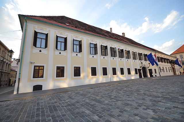
St. Mark's Square (Croatian: Trg svetog Marka) is a square located in the old part of Zagreb, Croatia. In the center of square is located St. Mark's Church. The square also sports important governmental buildings: Banski dvori (the seat of the Government of Croatia), Croatian Parliament (Croatian: Hrvatski sabor) and Constitutional Court of Croatia. On the corner of St. Mark's Square and the Street of Ćiril and Metod is the Old City Hall, where the Zagreb City Council held its sessions. In 2006 the square has undergone through renovation project. Since August 2005, the Government forbid any form of protests on St. Mark's square which caused many controversies in Croatian's "civil society". This ban was partially lifted in 2012. The square is also the site of the inaugurations of Croatia's presidents. Franjo Tuđman took his oath as President of the Republic in 1992 and 1997, Stjepan Mesić in 2000 and 2005 and Ivo Josipović in 2010 [Wikipedia.org] |
| Datum | |
| Zdroj | St. Mark's Square |
| Autor | Jorge Láscar from Australia |
| Pozice fotografa | | Tento snímek a mnohé další na: OpenStreetMap |
|---|
.jpg¶ms=045.816389_N_0015.973889_E_globe:Earth_type:camera_source:Flickr_&language=cs)
Licence
- Dílo smíte:
- šířit – kopírovat, distribuovat a sdělovat veřejnosti
- upravovat – pozměňovat, doplňovat, využívat celé nebo částečně v jiných dílech
- Za těchto podmínek:
- uveďte autora – Máte povinnost uvést autorství, poskytnout odkaz na licenci a uvést, pokud jste provedli změny. Toho můžete docílit jakýmkoli rozumným způsobem, avšak ne způsobem naznačujícím, že by poskytovatel licence schvaloval nebo podporoval vás nebo vaše užití díla.
| This image was originally posted to Flickr by Jorge Lascar at https://www.flickr.com/photos/8721758@N06/13023806233. It was reviewed on 2. dubna 2014 by FlickreviewR and was confirmed to be licensed under the terms of the cc-by-2.0. |

|
Kategorie tohoto souboru by měly být zkontrolovány. Zkontrolovat nyní!
|
.jpg&action=edit&withJS=MediaWiki:Catcheck.js)
Historie souboru
Kliknutím na datum a čas se zobrazí tehdejší verze souboru.
| Datum a čas | Náhled | Rozměry | Uživatel | Komentář | |
|---|---|---|---|---|---|
| současná | 2. 4. 2014, 08:27 | | 4 288 × 2 848 (3,34 MB) | Russavia | Transferred from Flickr |
Využití souboru
Tento soubor používají následující 3 stránky:
Globální využití souboru
Tento soubor využívají následující wiki:
- Využití na be-tarask.wikipedia.org
- Využití na en.wikipedia.org
- Využití na fr.wikipedia.org
- Využití na he.wikipedia.org
- Využití na hr.wikipedia.org
- Využití na hu.wikipedia.org
- Využití na nl.wikipedia.org
- Využití na sr.wikipedia.org
- Využití na sv.wikipedia.org
- Využití na www.wikidata.org
- Využití na zh.wikipedia.org
.jpg)