Soubor:Southernmost point buoy, NE view.jpg
Velikost tohoto náhledu: 800 × 533 pixelů. Jiná rozlišení: 320 × 213 pixelů | 640 × 427 pixelů | 1 024 × 682 pixelů | 1 280 × 853 pixelů | 2 560 × 1 706 pixelů | 4 000 × 2 666 pixelů.
Původní soubor (4 000 × 2 666 pixelů, velikost souboru: 4,12 MB, MIME typ: image/jpeg)
| Tento soubor pochází z Wikimedia Commons. Níže jsou zobrazeny informace, které obsahuje jeho tamější stránka s popisem souboru. |
Popis
| Popis |
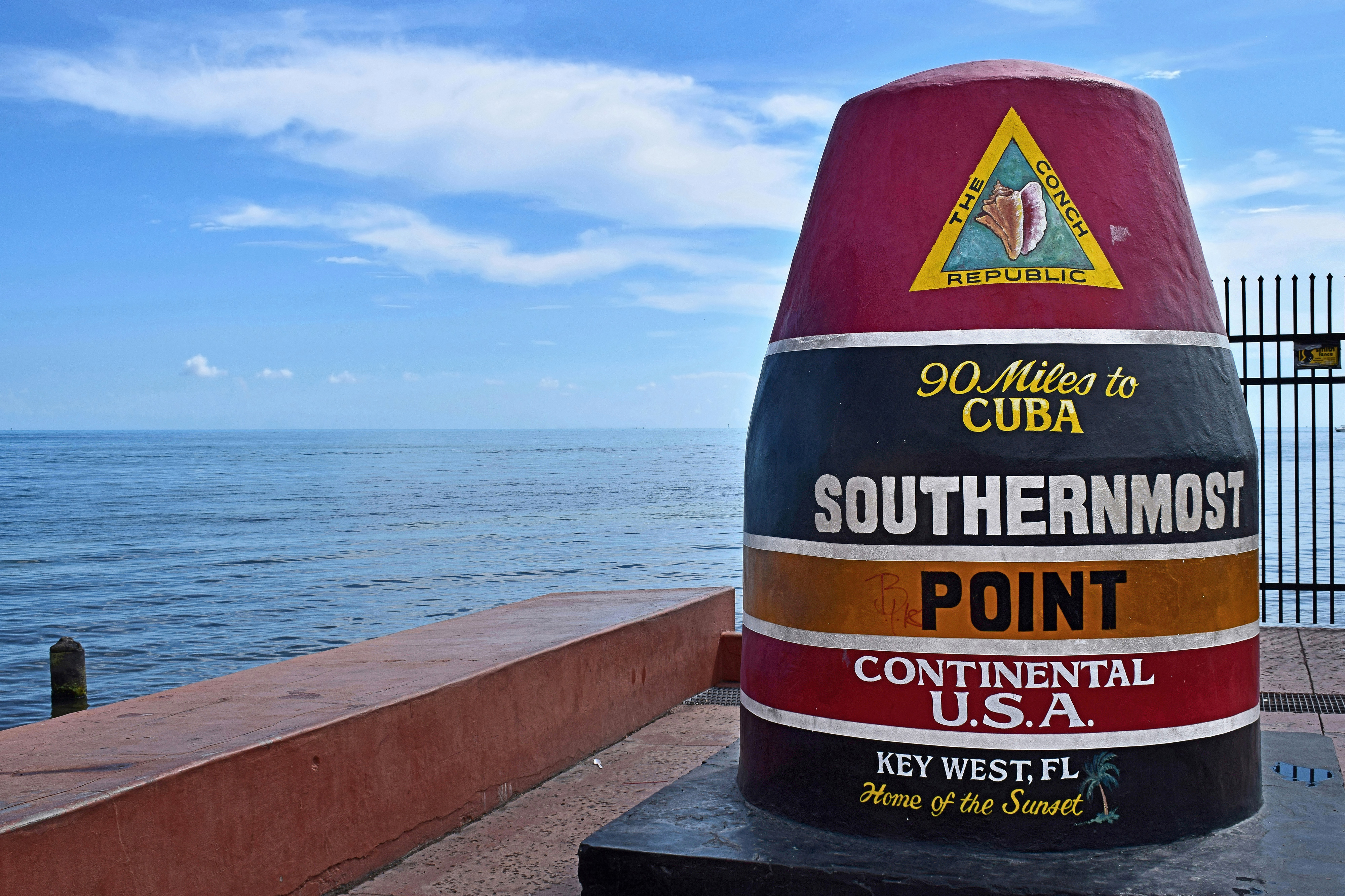
Polski: Najbardziej wysunięty na południe punkt Stanów Zjednoczonych w Key West, Floryda |
| Datum | Snímek pořízen 22. srpna 2018, 15:11:15 (UTC−5) |
| Zdroj | Vlastní dílo |
| Autor | Radomianin |
| Pozice fotografa | | Tento snímek a mnohé další na: OpenStreetMap |
|---|
| Uveďte autora (vyžadováno licencí) | © Radomianin / Wikimedia Commons / CC BY-SA 4.0 |
| Using this image | You can use this image file free of charge under the terms of the free license CC BY-SA 4.0. In particular, this means:
|
| Editing this image |
|
Photo of the Southernmost point buoy, view from northeast. Contrary to the buoy inscription and file metadata, the Cuban mainland is about 153 km (95 statute miles) due south.
Zhodnocení
Tento obrázek byl ohodnocen podle požadavků na Kvalitní obrázky a je považován za kvalitní obrázek.
|
Licence
Já, držitel autorských práv k tomuto dílu, ho tímto zveřejňuji za podmínek následující licence:
Tento soubor podléhá licenci Creative Commons Uveďte autora-Zachovejte licenci 4.0 International
- Dílo smíte:
- šířit – kopírovat, distribuovat a sdělovat veřejnosti
- upravovat – pozměňovat, doplňovat, využívat celé nebo částečně v jiných dílech
- Za těchto podmínek:
- uveďte autora – Máte povinnost uvést autorství, poskytnout odkaz na licenci a uvést, pokud jste provedli změny. Toho můžete docílit jakýmkoli rozumným způsobem, avšak ne způsobem naznačujícím, že by poskytovatel licence schvaloval nebo podporoval vás nebo vaše užití díla.
- zachovejte licenci – Pokud tento materiál jakkoliv upravíte, přepracujete nebo použijete ve svém díle, musíte své příspěvky šířit pod stejnou nebo slučitelnou licencí jako originál.
Historie souboru
Kliknutím na datum a čas se zobrazí tehdejší verze souboru.
| Datum a čas | Náhled | Rozměry | Uživatel | Komentář | |
|---|---|---|---|---|---|
| současná | 21. 11. 2020, 01:23 | | 4 000 × 2 666 (4,12 MB) | Radomianin | slight noise reduction in the sky area |
| 4. 12. 2018, 13:33 |  | 4 000 × 2 666 (3,09 MB) | Radomianin | Farbsättigung, Kontrast und Metadaten bearbeitet | |
| 27. 11. 2018, 12:55 |  | 4 000 × 2 666 (3,02 MB) | Radomianin | Dynamikumfang vergrößert, Metadaten aktualisiert, Auflösung verringert |
Využití souboru
Tento soubor používá následující stránka:
Globální využití souboru
Tento soubor využívají následující wiki:
- Využití na be.wikipedia.org
- Využití na br.wikipedia.org
- Využití na de.wikipedia.org
- Využití na en.wikipedia.org
- Využití na ja.wikipedia.org
- Využití na nl.wikipedia.org
- Využití na pl.wikipedia.org
- Využití na ro.wikipedia.org
- Využití na www.wikidata.org