Soubor:Satellite image of Thomas Fire.jpg

Velikost tohoto náhledu: 548 × 600 pixelů. Jiná rozlišení: 219 × 240 pixelů | 439 × 480 pixelů | 702 × 768 pixelů | 936 × 1 024 pixelů | 1 872 × 2 048 pixelů | 3 456 × 3 781 pixelů.
Původní soubor (3 456 × 3 781 pixelů, velikost souboru: 1,88 MB, MIME typ: image/jpeg)
| Tento soubor pochází z Wikimedia Commons. Níže jsou zobrazeny informace, které obsahuje jeho tamější stránka s popisem souboru. |
Popis
| Popis |
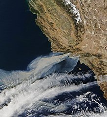
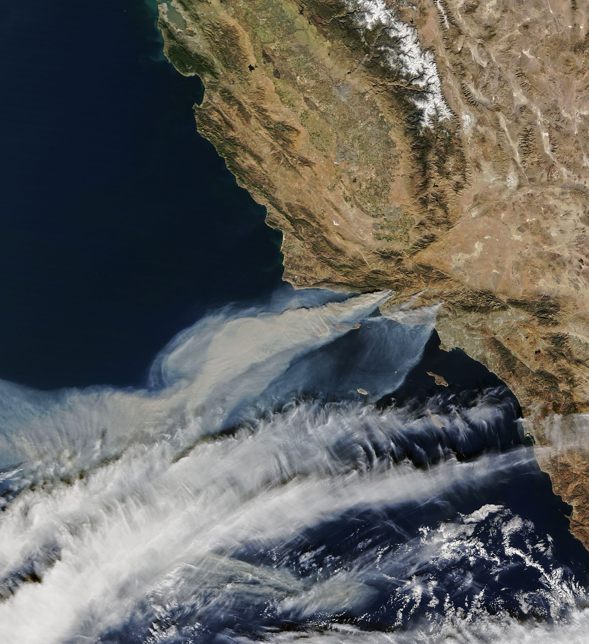
English: Satellite image from the Terra satellite of the smoke from the Thomas Fire in Ventura County, on December 5, along with the smoke from 2 other smaller fires, in Southern California. |
| Datum | Snímek pořízen 5. prosince 2017, 10:52:11 |
| Zdroj | https://earthobservatory.nasa.gov/NaturalHazards/view.php?id=91379 |
| Autor |
NASA Earth Observatory images by Joshua Stevens, using MODIS data. Instrument(s): Terra - MODIS |
| Svolení (Užití tohoto souboru) |
NASA |
Licence
| This file is in the public domain in the United States because it was solely created by NASA. NASA copyright policy states that "NASA material is not protected by copyright unless noted". (See Template:PD-USGov, NASA copyright policy page or JPL Image Use Policy.) | ||
 |
Warnings:
|
Historie souboru
Kliknutím na datum a čas se zobrazí tehdejší verze souboru.
| Datum a čas | Náhled | Rozměry | Uživatel | Komentář | |
|---|---|---|---|---|---|
| současná | 6. 12. 2017, 09:15 | | 3 456 × 3 781 (1,88 MB) | FriarTuck1981 | Reverted to version as of 07:13, 6 December 2017 (UTC) |
| 6. 12. 2017, 09:14 |  | 4 879 × 5 338 (2,3 MB) | FriarTuck1981 | Reverted to version as of 07:11, 6 December 2017 (UTC) | |
| 6. 12. 2017, 09:13 |  | 3 456 × 3 781 (1,88 MB) | FriarTuck1981 | cropped photo | |
| 6. 12. 2017, 09:11 |  | 4 879 × 5 338 (2,3 MB) | FriarTuck1981 | User created page with UploadWizard |
Využití souboru
Tento soubor používá následující stránka:
Globální využití souboru
Tento soubor využívají následující wiki:
- Využití na ar.wikipedia.org
- Využití na en.wikipedia.org
- Využití na es.wikinews.org
- Využití na fa.wikipedia.org
- Využití na ms.wikipedia.org
- Využití na vi.wikipedia.org
- Využití na www.wikidata.org
- Využití na zh.wikipedia.org