Soubor:River Wye estuary and M48 Wye road bridge.jpg
Velikost tohoto náhledu: 800 × 531 pixelů. Jiná rozlišení: 320 × 213 pixelů | 640 × 425 pixelů | 1 024 × 680 pixelů | 1 280 × 850 pixelů | 2 560 × 1 700 pixelů | 4 288 × 2 848 pixelů.
Původní soubor (4 288 × 2 848 pixelů, velikost souboru: 5,92 MB, MIME typ: image/jpeg)
| Tento soubor pochází z Wikimedia Commons. Níže jsou zobrazeny informace, které obsahuje jeho tamější stránka s popisem souboru. |
| Popis |
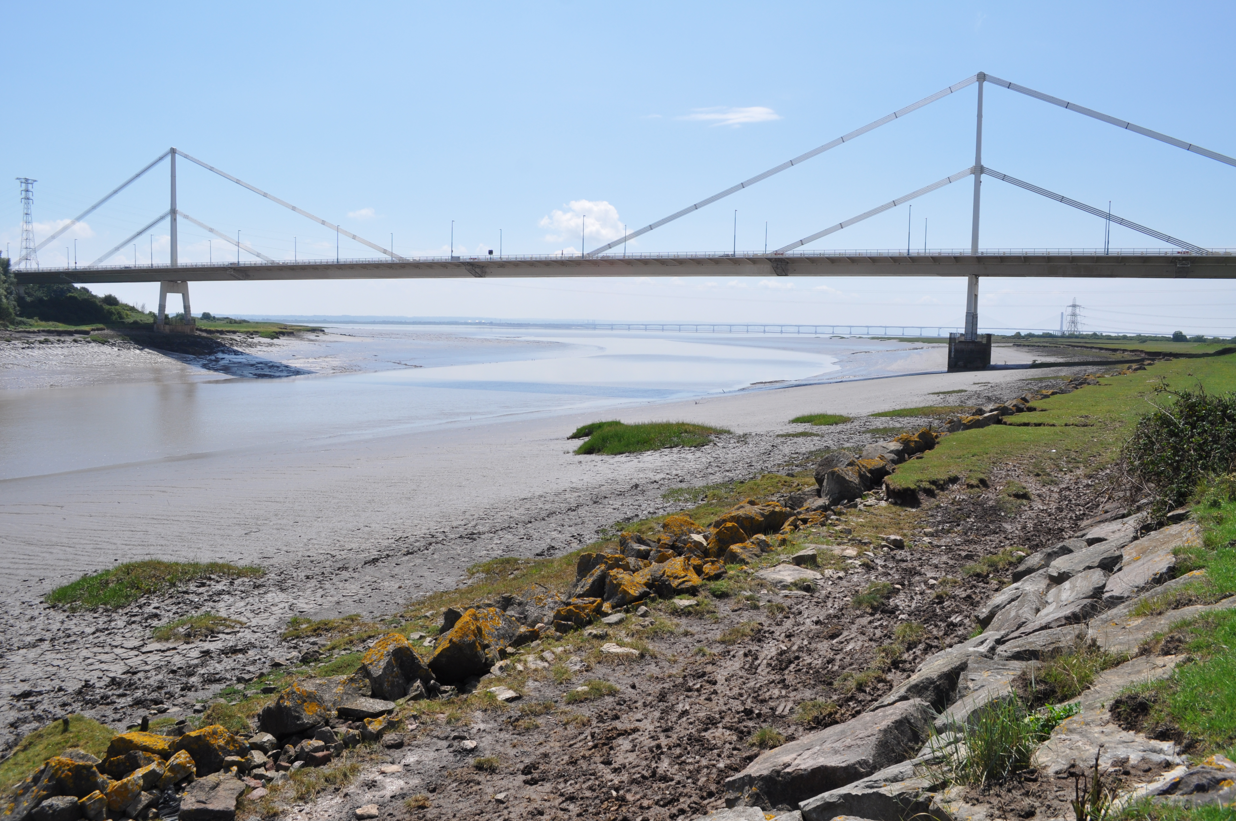
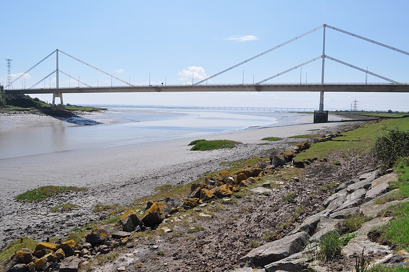
English: The Severn Bridge spans the River Severn between South Gloucestershire, England, and Monmouthshire in South Wales,
Français : Le pont de la Severn franchit la Severn entre le Gloucestershire du Sud, Angleterre et Sir Fynwy en Galles du Sud |
||
| Datum | |||
| Zdroj | From River Wye estuary and M48 Wye road bridge, near to Beachley, Gloucestershire, Great Britain - Geograph.org.uk | ||
| Autor | Nicholas Mutton | ||
| Svolení (Užití tohoto souboru) |
Tento soubor podléhá licenci Creative Commons Uveďte autora-Zachovejte licenci 2.0 Generic Uveďte autora: Nicholas Mutton
|
||
| Uveďte autora (vyžadováno licencí) | Nicholas Mutton / River Wye estuary and M48 Wye road bridge / | ||

| Pozice fotografa | | Tento snímek a mnohé další na: OpenStreetMap |
|---|
Historie souboru
Kliknutím na datum a čas se zobrazí tehdejší verze souboru.
| Datum a čas | Náhled | Rozměry | Uživatel | Komentář | |
|---|---|---|---|---|---|
| současná | 10. 9. 2017, 16:55 | | 4 288 × 2 848 (5,92 MB) | Geograph Update Bot | Higher-resolution version from Geograph. |
| 13. 11. 2010, 12:55 |  | 640 × 425 (78 KB) | Glabb | {{Information |Description = {{en|The '''Severn Bridge''' spans the River Severn between South Gloucestershire, England, and Monmouthshire in South Wales,}} {{fr|Le '''pont de la Severn''' franchit la Severn entr |
Využití souboru
Tento soubor používá následující stránka:
Globální využití souboru
Tento soubor využívají následující wiki:
- Využití na da.wikipedia.org
- Využití na en.wikipedia.org
- Využití na es.wikipedia.org
- Využití na fa.wikipedia.org
- Využití na fr.wikipedia.org
- Využití na ja.wikipedia.org
- Využití na mr.wikipedia.org
- Využití na ru.wikipedia.org
- Využití na sk.wikipedia.org
- Využití na sl.wikipedia.org
- Využití na www.wikidata.org