Soubor:Relief Map of Franz Josef Land.png
Větší rozlišení není k dispozici
Relief_Map_of_Franz_Josef_Land.png (600 × 427 pixelů, velikost souboru: 403 KB, MIME typ: image/png)
| Tento soubor pochází z Wikimedia Commons. Níže jsou zobrazeny informace, které obsahuje jeho tamější stránka s popisem souboru. |
Popis
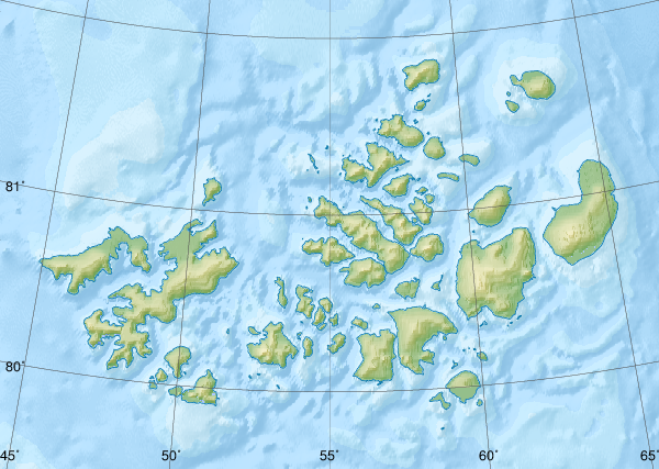
| Popis |
Русский: Физическая карта -- Земля Франца-Иосифа, Россия.
|
| Datum | |
| Zdroj |
|
| Autor | Nzeemin |
| Další verze |
|

Licence
Já, držitel autorských práv k tomuto dílu, ho tímto zveřejňuji za podmínek následující licence:
Tento soubor podléhá licenci Creative Commons Uveďte autora-Zachovejte licenci 3.0 Unported.
- Dílo smíte:
- šířit – kopírovat, distribuovat a sdělovat veřejnosti
- upravovat – pozměňovat, doplňovat, využívat celé nebo částečně v jiných dílech
- Za těchto podmínek:
- uveďte autora – Máte povinnost uvést autorství, poskytnout odkaz na licenci a uvést, pokud jste provedli změny. Toho můžete docílit jakýmkoli rozumným způsobem, avšak ne způsobem naznačujícím, že by poskytovatel licence schvaloval nebo podporoval vás nebo vaše užití díla.
- zachovejte licenci – Pokud tento materiál jakkoliv upravíte, přepracujete nebo použijete ve svém díle, musíte své příspěvky šířit pod stejnou nebo slučitelnou licencí jako originál.
Historie souboru
Kliknutím na datum a čas se zobrazí tehdejší verze souboru.
| Datum a čas | Náhled | Rozměry | Uživatel | Komentář | |
|---|---|---|---|---|---|
| současná | 17. 10. 2018, 11:41 | | 600 × 427 (403 KB) | RosssW | Полуостров стал островом https://ru.wikipedia.org/wiki/Остров_Юрия_Кучиева |
| 15. 5. 2012, 19:57 |  | 600 × 427 (374 KB) | Nzeemin | bathymetry interpolated | |
| 7. 4. 2012, 10:50 |  | 600 × 427 (251 KB) | Nzeemin | frame removed | |
| 17. 3. 2012, 21:14 |  | 600 × 427 (251 KB) | Nzeemin | plus bathymetry | |
| 10. 3. 2012, 21:57 |  | 600 × 427 (95 KB) | Nzeemin |
Využití souboru
Tento soubor používá následující stránka:
Globální využití souboru
Tento soubor využívají následující wiki:
- Využití na az.wikipedia.org
- Využití na be.wikipedia.org
- Využití na de.wikipedia.org
- Hayes-Insel
- Wilczek-Insel
- Wilczekland
- Rudolf-Insel
- Graham-Bell-Insel
- Hall-Insel (Franz-Josef-Land)
- Alexandraland
- Prinz-Georg-Land
- Koldewey-Insel
- Wiener-Neustadt-Insel
- Hohenlohe-Insel
- Northbrook-Insel
- Hooker-Insel
- Eva-Liv-Insel
- Jackson-Insel
- Champ-Insel
- Alger-Insel
- Vorlage:Positionskarte Franz-Josef-Land
- Ziegler-Insel
- Salisbury-Insel
- McClintock-Insel
- Perlmutt-Insel
- Arthur-Insel
- La-Ronciere-Insel
- Bell-Insel
- Mabel-Insel
- Becker-Insel
- Greely-Insel
- Salm-Insel
- Kane-Insel
- Kuhn-Insel (Franz-Josef-Land)
- Karl-Alexander-Insel
- Hoffmann-Insel
- Lütke-Insel
- Brosch-Insel
- Hochstetter-Inseln
- Luigi-Insel
- Bruce-Insel
- Rainer-Insel
Zobrazit další globální využití tohoto souboru.