Soubor:North Rhine-Westphalia location map 01.svg

Velikost tohoto PNG náhledu tohoto SVG souboru: 527 × 524 pixelů. Jiná rozlišení: 241 × 240 pixelů | 483 × 480 pixelů | 772 × 768 pixelů | 1 030 × 1 024 pixelů | 2 060 × 2 048 pixelů.
Původní soubor (soubor SVG, nominální rozměr: 527 × 524 pixelů, velikost souboru: 1,22 MB)
| Tento soubor pochází z Wikimedia Commons. Níže jsou zobrazeny informace, které obsahuje jeho tamější stránka s popisem souboru. |
Popis
| Popis |
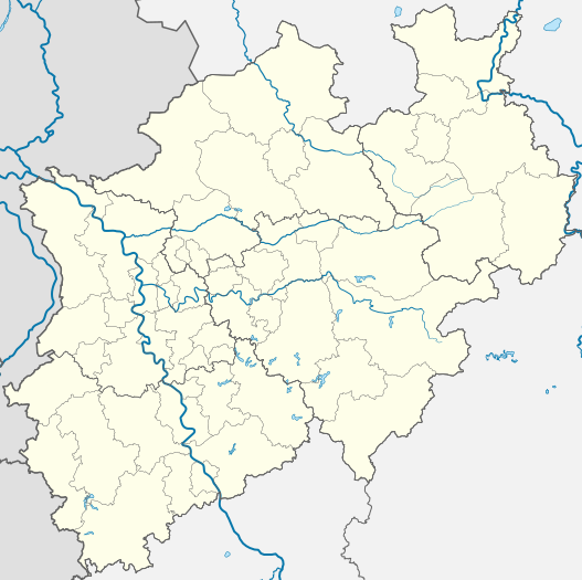
Deutsch: Positionskarte Nordrhein-Westfalen, Germany. Geographische Begrenzung der Karte:
English: Location map North Rhine-Westphalia, Germany. Geographic limits of the map:
Français : Carte du land Rhénanie-du-Nord-Westphalie (Allemagne) destinée à géolocalisation. Les limites géographiques sont:
|
|||||||||||||
| Datum | ||||||||||||||
| Zdroj |
Vlastní dílo, based on (not all layers may be visible or included):
Only to compare some issues: |
|||||||||||||
| Autor |
TUBS |
|||||||||||||
| Další verze |
[]
|
|||||||||||||
| SVG vývoj | Tento vektorový obrázek byl vytvořen programem Adobe Illustrator |


Licence
TUBS
 , držitel autorských práv k tomuto dílu, ho tímto zveřejňuje za podmínek následujících licencí:

|
Tento dokument smí být kopírován, šířen nebo upravován podle podmínek Svobodné licence GNU pro dokumenty verze 1.2 nebo libovolné vyšší verze publikované nadací Free Software Foundation. Dokument nemá neměnné části ani texty na předním či zadním přebalu. Kopie textu licence je k dispozici v oddíle nazvaném GNU Free Documentation License. |
Tento soubor podléhá licenci Creative Commons Uveďte autora 3.0 Unported, 2.5 Generic, 2.0 Generic a 1.0 Generic.
Uveďte autora: TUBS
- Dílo smíte:
- šířit – kopírovat, distribuovat a sdělovat veřejnosti
- upravovat – pozměňovat, doplňovat, využívat celé nebo částečně v jiných dílech
- Za těchto podmínek:
- uveďte autora – Máte povinnost uvést autorství, poskytnout odkaz na licenci a uvést, pokud jste provedli změny. Toho můžete docílit jakýmkoli rozumným způsobem, avšak ne způsobem naznačujícím, že by poskytovatel licence schvaloval nebo podporoval vás nebo vaše užití díla.
Tento soubor podléhá licenci Creative Commons Uveďte autora-Zachovejte licenci 3.0 Unported, 2.5 Generic, 2.0 Generic a 1.0 Generic.
Uveďte autora: TUBS
- Dílo smíte:
- šířit – kopírovat, distribuovat a sdělovat veřejnosti
- upravovat – pozměňovat, doplňovat, využívat celé nebo částečně v jiných dílech
- Za těchto podmínek:
- uveďte autora – Máte povinnost uvést autorství, poskytnout odkaz na licenci a uvést, pokud jste provedli změny. Toho můžete docílit jakýmkoli rozumným způsobem, avšak ne způsobem naznačujícím, že by poskytovatel licence schvaloval nebo podporoval vás nebo vaše užití díla.
- zachovejte licenci – Pokud tento materiál jakkoliv upravíte, přepracujete nebo použijete ve svém díle, musíte své příspěvky šířit pod stejnou nebo slučitelnou licencí jako originál.
| Tento soubor byl uvolněn pomocí Creative Commons CC0 1.0 Universal Public Domain Dedication. | |
| Osoba, která toto dílo označila tímto dokumentem, dílo uvolnila do public domain tím, že se celosvětově vzdala všech autorských práv ke svému dílu včetně všech souvisejících a příbuzných zákonných práv, které k dílu má, v rozsahu umožněném zákonem. Můžete toto dílo rozmnožovat, upravovat, rozšiřovat či provozovat, i pro komerční účely, vše bez nutnosti žádat o svolení.
|
| Já, autor tohoto díla, jej tímto uvolňuji jako volné dílo, a to celosvětově. V některých zemích to není podle zákona možné; v takovém případě: Poskytuji komukoli právo užívat toto dílo za libovolným účelem, a to bezpodmínečně s výjimkou podmínek vyžadovaných zákonem. |
| Copyleft: Toto umělecké dílo je svobodné; můžete jej distribuovat v souladu s podmínkami Free Art License. Kopii této licence najdete na stránkách Copyleft Attitude i jinde. |

|
Držitel autorských práv k tomuto souboru, TUBS |
|
|
Můžete si zvolit libovolnou z těchto licencí.

|
I'd greatly appreciate, that you attribute this media file to Wikimedia Commons, if used outside Wikipedia or Commons. For use in publications such as books, newspapers, blogs, websites, please insert here the following line:
|
Historie souboru
Kliknutím na datum a čas se zobrazí tehdejší verze souboru.
| Datum a čas | Náhled | Rozměry | Uživatel | Komentář | |
|---|---|---|---|---|---|
| současná | 16. 12. 2009, 21:35 | | 527 × 524 (1,22 MB) | TUBS | korr crop area |
| 20. 10. 2009, 11:05 |  | 657 × 656 (476 KB) | TUBS | -ac | |
| 26. 1. 2009, 22:33 |  | 657 × 656 (479 KB) | TUBS | {{Information |Description= |Source= |Date= |Author= |Permission= |other_versions= }} | |
| 26. 1. 2009, 22:26 |  | 657 × 656 (479 KB) | TUBS | {{Information |Description= |Source= |Date= |Author= |Permission= |other_versions= }} | |
| 4. 11. 2008, 10:23 |  | 657 × 656 (429 KB) | TUBS | {{Information |Description= |Source= |Date= |Author= |Permission= |other_versions= }} | |
| 9. 10. 2008, 10:40 |  | 657 × 656 (424 KB) | TUBS | {{Information |Description= |Source= |Date= |Author= |Permission= |other_versions= }} | |
| 9. 10. 2008, 10:38 |  | 688 × 688 (424 KB) | TUBS | {{Information |Description= |Source= |Date= |Author= |Permission= |other_versions= }} | |
| 8. 10. 2008, 10:44 |  | 654 × 656 (424 KB) | TUBS | *reduced stroke thickness again (rivers and districts) | |
| 8. 10. 2008, 10:27 |  | 654 × 656 (424 KB) | TUBS | *lightened district borders | |
| 8. 10. 2008, 10:09 |  | 654 × 656 (424 KB) | TUBS | *added transpareny to all those above-rivers-lines *moved the rivers aside the borders |
Využití souboru
Tento soubor používá následující stránka:
Globální využití souboru
Tento soubor využívají následující wiki:
- Využití na als.wikipedia.org
- Využití na ar.wikipedia.org
- Využití na azb.wikipedia.org
- Využití na az.wikipedia.org
- Vuppertal
- Şablon:Yer xəritəsi Almaniya Şimali Reyn-Vestfaliya
- Kosfeld
- Hagen
- Hamm
- Mönxenqladbax
- Mülhaym
- Münster
- Remşayd
- Herne (Şimali Reyn-Vestfaliya)
- Drenştaynfurt
- İsselburq
- Ştaynfurt
- Varendorf
- Zassenberq
- Zendenhorst
- Hayligenhaus
- Ratingen
- Verl
- Datteln
- Emsdetten
- Or-Erkenşvik
- Rede
- Telqte
- Teklenburq
- Velen
- Villix
- Ziqen
- UEFA Avropa Liqası 2019/2020
- Využití na ba.wikipedia.org
- Využití na bg.wikipedia.org
- Využití na bn.wikipedia.org
- Využití na ceb.wikipedia.org
- Využití na cv.wikipedia.org
- Využití na da.wikipedia.org
Zobrazit další globální využití tohoto souboru.