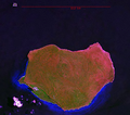
Soubor:Mona Landsat7 Pseudo.png

Velikost tohoto náhledu: 680 × 599 pixelů. Jiná rozlišení: 272 × 240 pixelů | 545 × 480 pixelů | 690 × 608 pixelů.
Původní soubor (690 × 608 pixelů, velikost souboru: 1,2 MB, MIME typ: image/png)
Historie souboru
Kliknutím na datum a čas se zobrazí tehdejší verze souboru.
| Datum a čas | Náhled | Rozměry | Uživatel | Komentář | |
|---|---|---|---|---|---|
| současná | 19. 2. 2007, 20:48 |  | 690 × 608 (1,2 MB) | Ratzer | NASA World Wind screen image Landsat 7 Pseudo color Mona Island, Puerto Rico |
Využití souboru
Tento soubor používají následující 2 stránky:
Globální využití souboru
Tento soubor využívají následující wiki:
- Využití na arz.wikipedia.org
- Využití na br.wikipedia.org
- Využití na ca.wikipedia.org
- Využití na ceb.wikipedia.org
- Využití na el.wikipedia.org
- Využití na en.wikipedia.org
- Využití na en.wikivoyage.org
- Využití na es.wikipedia.org
- Využití na et.wikipedia.org
- Využití na eu.wikipedia.org
- Využití na fa.wikipedia.org
- Využití na it.wikivoyage.org
- Využití na ja.wikipedia.org
- Využití na ko.wikipedia.org
- Využití na pl.wikipedia.org
- Využití na sv.wikipedia.org
- Využití na sw.wikipedia.org
- Využití na szl.wikipedia.org
- Využití na tr.wikipedia.org
- Využití na tt.wikipedia.org
- Využití na ur.wikipedia.org
- Využití na vec.wikipedia.org
- Využití na www.wikidata.org
- Využití na zh.wikipedia.org
