Soubor:Modiin1870s.jpg
Velikost tohoto náhledu: 627 × 599 pixelů. Jiná rozlišení: 251 × 240 pixelů | 502 × 480 pixelů | 803 × 768 pixelů | 1 094 × 1 046 pixelů.
Původní soubor (1 094 × 1 046 pixelů, velikost souboru: 245 KB, MIME typ: image/jpeg)
| Tento soubor pochází z Wikimedia Commons. Níže jsou zobrazeny informace, které obsahuje jeho tamější stránka s popisem souboru. |
Popis
| Popis |
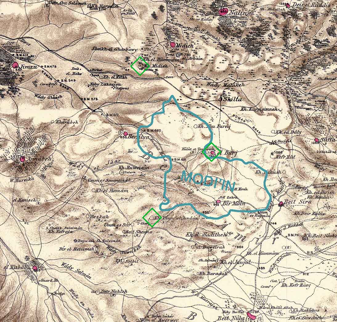
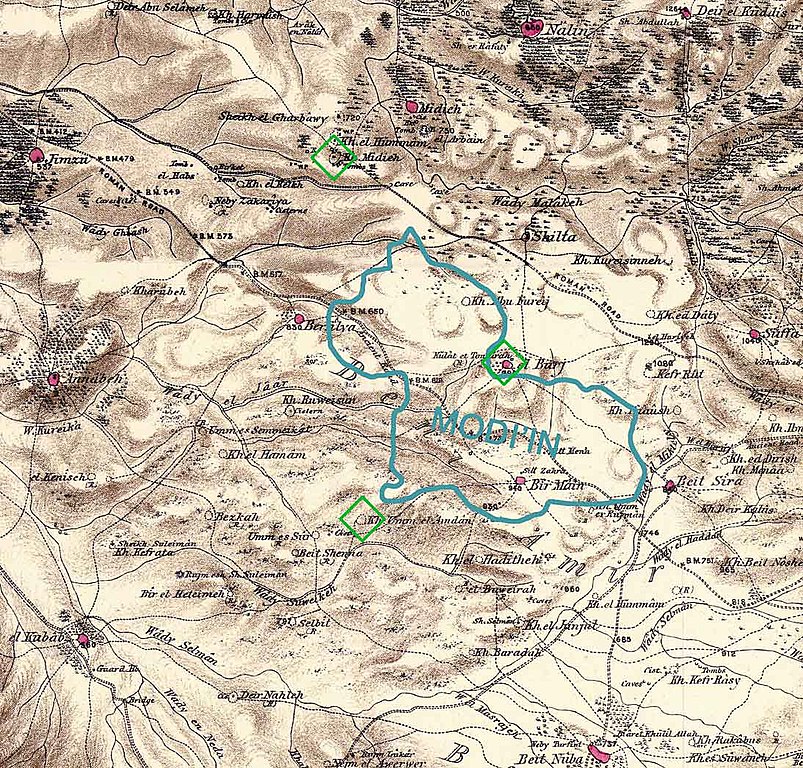
Combination of portions of two maps produced by the Survey of Western Palestine, first published in 1880 by the Committee of the Palestine Exploration Fund. The editor, Walter Besant, died in 1901. The blue shape gives the approximate boundaries of the build-up area of Modi'in in 2006 (Google Earth). The green diamonds show three scientific theories regarding the location of the ancient city of Modi'in. There are other popular theories. Produced by Zero0000 using Photoshop 7.0. |
| Datum | 28. ledna 2007 (datum prvotního načtení souboru) |
| Zdroj | No machine-readable source provided. Own work assumed (based on copyright claims). |
| Autor | No machine-readable author provided. Zero0000 assumed (based on copyright claims). |
Licence
| Já, autor tohoto díla, jej tímto uvolňuji jako volné dílo, a to celosvětově. V některých zemích to není podle zákona možné; v takovém případě: Poskytuji komukoli právo užívat toto dílo za libovolným účelem, a to bezpodmínečně s výjimkou podmínek vyžadovaných zákonem. |
Historie souboru
Kliknutím na datum a čas se zobrazí tehdejší verze souboru.
| Datum a čas | Náhled | Rozměry | Uživatel | Komentář | |
|---|---|---|---|---|---|
| současná | 28. 1. 2007, 12:08 | | 1 094 × 1 046 (245 KB) | Zero0000 | Combination of portions of two maps produced by the Survey of Western Palestine, first published in 1880 by the Committee of the Palestine Exploration Fund. The editor, Walter Besant, died in 1901. The blue shape gives the approximate boundaries of the b |
Využití souboru
Tento soubor používá následující stránka:
Globální využití souboru
Tento soubor využívají následující wiki:
- Využití na el.wikipedia.org
- Využití na en.wikipedia.org
- Využití na he.wikipedia.org
- Využití na id.wikipedia.org
- Využití na nn.wikipedia.org
- Využití na no.wikipedia.org
- Využití na pl.wikipedia.org
- Využití na sco.wikipedia.org