Soubor:Mathieu-Louis Molé.JPG

Původní soubor (604 × 787 pixelů, velikost souboru: 451 KB, MIME typ: image/jpeg)
| Tento soubor pochází z Wikimedia Commons. Níže jsou zobrazeny informace, které obsahuje jeho tamější stránka s popisem souboru. |
Popis
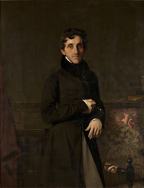
| Jean Auguste Dominique Ingres: Portrait of Louis-Mathieu Molé
|
|||||||||||||||||||||||||||
|---|---|---|---|---|---|---|---|---|---|---|---|---|---|---|---|---|---|---|---|---|---|---|---|---|---|---|---|
| Tvůrce |
|
 | |||||||||||||||||||||||||
| Název |
francouzština: Portrait du comte Mathieu-Louis Molé (1781-1855) Portrait of Louis-Mathieu Molé |
||||||||||||||||||||||||||
| Druh objektu |
malba |
||||||||||||||||||||||||||
| Žánr |
portrét |
||||||||||||||||||||||||||
| Popis |
English: Louis-Mathieu Molé (1781-1855) - French statesman and 18th Prime Minister of France |
||||||||||||||||||||||||||
| Depicted people |
Louis-Mathieu Molé |
||||||||||||||||||||||||||
| Datum | 1834 | ||||||||||||||||||||||||||
| Technika |
olej na plátně |
||||||||||||||||||||||||||
| Rozměry |
výška: 147 cm |
||||||||||||||||||||||||||
| Sbírka |
|
||||||||||||||||||||||||||
| Současné umístění | |||||||||||||||||||||||||||
| Inventární číslo |
RF 2009-15 and RF 2009 15 (Oddělení maleb muzea Louvre) |
||||||||||||||||||||||||||
| Reference | |||||||||||||||||||||||||||
| Soubor autorit | |||||||||||||||||||||||||||
| Zdroj/Fotograf | http://www.napoleon-empire.net/images/tableaux/t_mole.jpg | ||||||||||||||||||||||||||
| Svolení (Užití tohoto souboru) |
Public Domain | ||||||||||||||||||||||||||
| Další verze |
|
||||||||||||||||||||||||||


Licence
|
Toto je věrná fotografická reprodukce původního dvourozměrného uměleckého díla. Ono dílo je samo volným dílem, a to z následujícího důvodu:
Oficiálním stanoviskem nadace Wikimedia Foundation je, že „věrné reprodukce dvourozměrných volných děl jsou také volné a opačná tvrzení jsou útokem na samotný koncept volných děl.“ Podrobnosti naleznete na stránce Commons:When to use the PD-Art tag. Tato fotografická reprodukce se tedy také považuje za volné dílo. Uvědomte si, že v závislosti na místních zákonech může být další užití tohoto díla ve vaší jurisdikci zakázáno či omezeno. Vizte Commons:Reuse of PD-Art photographs. {{PD-Art}} template without license parameter: please specify why the underlying work is public domain in both the source country and the United States
(Usage: {{PD-Art|1=|deathyear=''year of author's death''|country=''source country''}}, where parameter 1= can be PD-old-auto, PD-old-auto-expired, PD-old-auto-1996, PD-old-100 or similar. See Commons:Multi-license copyright tags for more information.) | ||||
| Pozice fotografa | | Tento snímek a mnohé další na: OpenStreetMap |
|---|
Historie souboru
Kliknutím na datum a čas se zobrazí tehdejší verze souboru.
| Datum a čas | Náhled | Rozměry | Uživatel | Komentář | |
|---|---|---|---|---|---|
| současná | 24. 12. 2019, 19:41 | | 604 × 787 (451 KB) | Benj73 | quality |
| 13. 2. 2011, 10:29 |  | 435 × 576 (132 KB) | Charvex | {{Information |Description ={{en|1=Louis-Mathieu Molé (1781-1855) - French statesman and 18th Prime Minister of France}} |Source =http://www.napoleon-empire.net/images/tableaux/t_mole.jpg |Author =Jean-Auguste-Dominique Ingres (1780-18 |
Využití souboru
Tento soubor používá následující stránka:
Globální využití souboru
Tento soubor využívají následující wiki:
- Využití na af.wikipedia.org
- Využití na ar.wikipedia.org
- Využití na arz.wikipedia.org
- Využití na avk.wikipedia.org
- Využití na ca.wikipedia.org
- Využití na de.wikipedia.org
- Využití na el.wikipedia.org
- Využití na en.wikipedia.org
- Využití na eo.wikipedia.org
- Využití na eu.wikipedia.org
- Využití na fa.wikipedia.org
- Využití na fi.wikipedia.org
- Využití na fr.wikipedia.org
- Liste des membres de l'Académie française
- Monarchie de Juillet
- Gaspard-Gustave Coriolis
- François Guizot
- Camille de Montalivet
- Charles de Rémusat
- Premier ministère du règne de Louis-Philippe Ier
- Gouvernement Louis Mathieu Molé (1)
- Narcisse-Achille de Salvandy
- Tanneguy Duchâtel
- Félix Barthe
- Simon Bernard
- Jean-Charles Persil
- Adrien de Gasparin
- Gouvernement Louis Mathieu Molé (2)
- Claude du Campe de Rosamel
- Nicolas Martin du Nord
- Narcisse Parant
- Jean Lacave-Laplagne
- Liste des chefs du gouvernement français
- Élections législatives françaises de 1837
- Mathieu Molé
- Trésor national (France)
- Portrait du comte Louis-Mathieu Molé
- Modèle:Palette Gouvernement Molé I
- Modèle:Palette Gouvernement Molé II
Zobrazit další globální využití tohoto souboru.