Soubor:Lochaber UK location map.svg

Velikost tohoto PNG náhledu tohoto SVG souboru: 800 × 501 pixelů. Jiná rozlišení: 320 × 201 pixelů | 640 × 401 pixelů | 1 024 × 642 pixelů | 1 280 × 802 pixelů | 2 560 × 1 604 pixelů | 1 425 × 893 pixelů.
Původní soubor (soubor SVG, nominální rozměr: 1 425 × 893 pixelů, velikost souboru: 2,39 MB)
| Tento soubor pochází z Wikimedia Commons. Níže jsou zobrazeny informace, které obsahuje jeho tamější stránka s popisem souboru. |
| Popis |
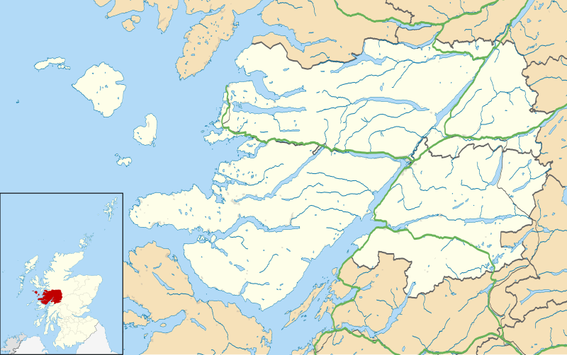
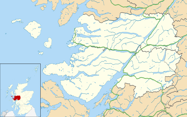
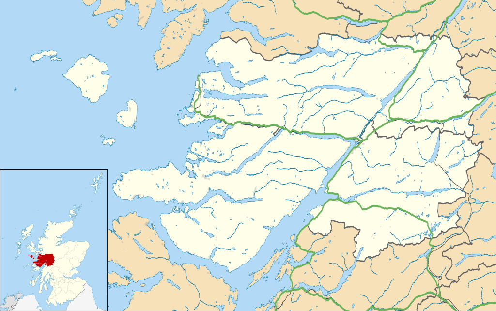
Map of the Lochaber ward management area, UK in 2011, with the following information shown:
Equirectangular map projection on WGS 84 datum, with N/S stretched 180% Geographic limits:
|
| Datum | |
| Zdroj |
|
| Autor | Nilfanion, created using Ordnance Survey data |
| Svolení (Užití tohoto souboru) |
Tento soubor podléhá licenci Creative Commons Uveďte autora-Zachovejte licenci 3.0 Unported Uveďte autora: Contains Ordnance Survey data © Crown copyright and database right
|
| Další verze | File:Lochaber UK blank map.svg - Blank map |
Historie souboru
Kliknutím na datum a čas se zobrazí tehdejší verze souboru.
| Datum a čas | Náhled | Rozměry | Uživatel | Komentář | |
|---|---|---|---|---|---|
| současná | 13. 2. 2011, 16:23 | | 1 425 × 893 (2,39 MB) | Nilfanion | {{Information |Description=Map of the Lochaber ward management area, UK in 2011, with the following information shown: *Ward boundaries *Coastline, lakes and rivers *Roads and railways *Urban areas Equirectangular map projection on WGS 84 |
Využití souboru
Tento soubor používá následující stránka:
Globální využití souboru
Tento soubor využívají následující wiki:
- Využití na ar.wikipedia.org
- Využití na ceb.wikipedia.org
- Využití na en.wikipedia.org
- Fort William, Scotland
- Back of Keppoch
- Glencoe, Highland
- Kinlochleven
- Mallaig
- Kilchoan
- Ballachulish
- Glenfinnan
- Onich
- Arisaig
- Morar
- Achnacarry
- Inverie
- Acharacle
- Achintee, Fort William
- Achosnich
- Achriabhach
- Portuairk
- Glenuig
- Laggan, Great Glen
- Morvern
- Banavie
- Lochailort
- Caol
- Aberchalder
- Achaphubuil
- Tarbet, Loch Nevis
- Glenborrodale
- Kilmory, Ardnamurchan
- Invergarry
- Blaich
- Achindarroch
- Alisary
- Ardery
- Ardmolich
- Ardtoe
- Bohuntine
- Bonnavoulin
- Ockle
- Bracora
- Bracorina
- Sanna, Ardnamurchan
- Belford Hospital
- Resipole
- Lochaline
- Roshven
- Achnasaul
- Ardechive
Zobrazit další globální využití tohoto souboru.