Soubor:Location Bié.PNG
Větší rozlišení není k dispozici
Location_Bié.PNG (361 × 363 pixelů, velikost souboru: 97 KB, MIME typ: image/png)
| Tento soubor pochází z Wikimedia Commons. Níže jsou zobrazeny informace, které obsahuje jeho tamější stránka s popisem souboru. |
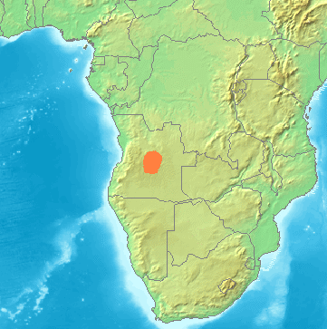
| Popis | Locator maps for mountain ranges , Bié (Angola) |
| Zdroj | demis maps, see below |
| Autor |
This image is in the public domain because it came from the site https://www.demis.nl/products/web-map-server/examples/ and was released by the copyright holder. Permission is granted to copy, distribute and/or modify this map since it is based on free of copyright images from: www.demis.nl. See also approval email on de.wp and its clarification.
|
| This work has been released into the public domain by its copyright holder, www.demis.nl. This applies worldwide. V některých zemích to není podle zákona možné; v takovém případě: www.demis.nl poskytuje komukoli právo užívat toto dílo za libovolným účelem, a to bezpodmínečně s výjimkou podmínek vyžadovaných zákonem.
|
Historie souboru
Kliknutím na datum a čas se zobrazí tehdejší verze souboru.
| Datum a čas | Náhled | Rozměry | Uživatel | Komentář | |
|---|---|---|---|---|---|
| současná | 23. 11. 2021, 05:16 | | 361 × 363 (97 KB) | Hallel | Reverted to version as of 14:38, 29 June 2007 (UTC) |
| 11. 8. 2021, 17:59 |  | 361 × 363 (241 KB) | Fährtenleser | falsche Lage korrigiert (Grundlage: http://mountainbiodiversity.org/explore sowie Topographie | |
| 29. 6. 2007, 16:38 |  | 361 × 363 (97 KB) | Michiel1972 | {{Information |Description=Locator maps for mountain ranges , Bié (Angola) |Source=demis maps, see below |Date= |Author= |Permission=see below |other_versions= }} {{PD-Demis}} Category:Maps of mountain_ranges_of_Europe |
Využití souboru
Tento soubor používá následující stránka:
Globální využití souboru
Tento soubor využívají následující wiki:
- Využití na bg.wikipedia.org
- Využití na ca.wikipedia.org
- Využití na ceb.wikipedia.org
- Využití na de.wikipedia.org
- Využití na en.wikipedia.org
- Využití na es.wikipedia.org
- Využití na fr.wikipedia.org
- Využití na hr.wikipedia.org
- Využití na hu.wikipedia.org
- Využití na it.wikipedia.org
- Využití na lt.wikipedia.org
- Využití na nl.wikipedia.org
- Využití na pl.wikipedia.org
- Využití na pt.wikipedia.org
- Využití na sh.wikipedia.org
- Využití na uk.wikipedia.org
- Využití na www.wikidata.org
- Využití na zh.wikipedia.org