Soubor:LAX Airport Diagram.svg

Velikost tohoto PNG náhledu tohoto SVG souboru: 378 × 552 pixelů. Jiná rozlišení: 164 × 240 pixelů | 329 × 480 pixelů | 526 × 768 pixelů | 701 × 1 024 pixelů | 1 402 × 2 048 pixelů.
Původní soubor (soubor SVG, nominální rozměr: 378 × 552 pixelů, velikost souboru: 1,09 MB)
| Tento soubor pochází z Wikimedia Commons. Níže jsou zobrazeny informace, které obsahuje jeho tamější stránka s popisem souboru. |
Popis
| Popis |
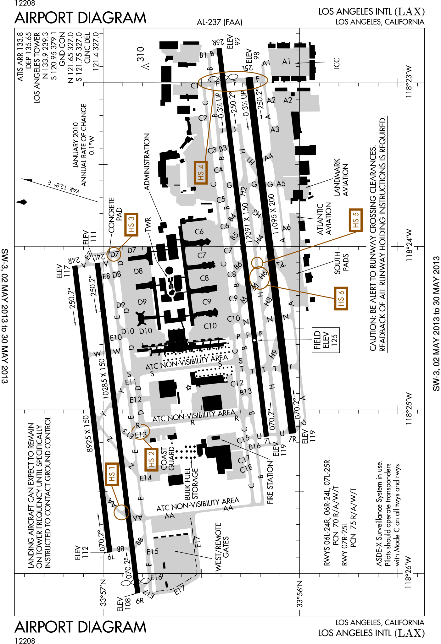
English: FAA Airport Diagram of Los Angeles International Airport. |
| Datum | |
| Zdroj |
FAA Airport Diagrams; note that these change every 28 days. Taken from PDF on FAA site and converted to SVG using en:Wikipedia:How to draw SVG circuits using Xcircuit. |
| Autor | Produced by the National Aeronautical Charting Office (NACO), a department of the United States en:Federal Aviation Administration. |
| Pozice fotografa | | Tento snímek a mnohé další na: OpenStreetMap |
|---|
W3C-validity not checked.
Licence
This image or file is a work of a Federal Aviation Administration employee, taken or made as part of that person's official duties. As a work of the U.S. federal government, the image is in the public domain in the United States.
|
 |
Historie souboru
Kliknutím na datum a čas se zobrazí tehdejší verze souboru.
| Datum a čas | Náhled | Rozměry | Uživatel | Komentář | |
|---|---|---|---|---|---|
| současná | 2. 5. 2013, 16:22 | | 378 × 552 (1,09 MB) | Grendelkhan | SVG version of FAA's PDF diagram. |
Využití souboru
Tento soubor používá následující stránka:
Globální využití souboru
Tento soubor využívají následující wiki:
- Využití na ca.wikipedia.org
- Využití na da.wikipedia.org
- Využití na de.wikipedia.org
- Využití na it.wikipedia.org
- Využití na mr.wikipedia.org
- Využití na www.wikidata.org