Soubor:Kvarner gulf map.png
Kvarner_gulf_map.png (401 × 584 pixelů, velikost souboru: 208 KB, MIME typ: image/png)
| Tento soubor pochází z Wikimedia Commons. Níže jsou zobrazeny informace, které obsahuje jeho tamější stránka s popisem souboru. |
| Popis |
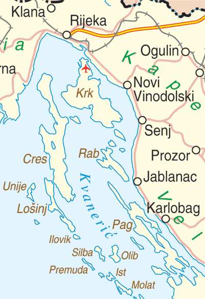
English: Map of the Kvarner Gulf, Croatia |
|||
| Datum | ||||
| Zdroj | http://www.un.org/Depts/Cartographic/map/profile/croatia.pdf | |||
| Autor | Department of Peacekeeping Operations Cartographic Section | |||
| Svolení (Užití tohoto souboru) |
|

Historie souboru
Kliknutím na datum a čas se zobrazí tehdejší verze souboru.
| Datum a čas | Náhled | Rozměry | Uživatel | Komentář | |
|---|---|---|---|---|---|
| současná | 14. 2. 2016, 00:04 | | 401 × 584 (208 KB) | Hrbackpacker | again. (sorry I am new) :) |
| 14. 2. 2016, 00:02 |  | 401 × 584 (210 KB) | Hrbackpacker | made mistake with upload, here is new file with correct airport location | |
| 14. 2. 2016, 00:01 |  | 401 × 584 (47 KB) | Hrbackpacker | Fixed location of Rijeka airport | |
| 30. 9. 2005, 22:07 |  | 401 × 584 (47 KB) | MRB | Map of the Kvarner Gulf, Croatia Extracted from http://www.un.org/Depts/Cartographic/map/profile/croatia.pdf {{PD}} |
Využití souboru
Tento soubor používají následující 2 stránky:
Globální využití souboru
Tento soubor využívají následující wiki:
- Využití na ar.wikipedia.org
- Využití na bg.wikipedia.org
- Využití na da.wikipedia.org
- Využití na de.wikipedia.org
- Využití na el.wikipedia.org
- Využití na en.wikipedia.org
- Využití na en.wikivoyage.org
- Využití na eo.wikipedia.org
- Využití na es.wikipedia.org
- Využití na et.wikipedia.org
- Využití na fa.wikipedia.org
- Využití na fi.wikipedia.org
- Využití na fr.wikipedia.org
- Využití na fr.wikivoyage.org
- Využití na he.wikipedia.org
- Využití na hr.wikipedia.org
- Využití na hu.wikipedia.org
- Využití na hyw.wikipedia.org
- Využití na it.wikipedia.org
- Využití na ja.wikipedia.org
- Využití na ka.wikipedia.org
- Využití na ko.wikipedia.org
- Využití na la.wikipedia.org
- Využití na lt.wikipedia.org
- Využití na mk.wikipedia.org
- Využití na nl.wikipedia.org
- Využití na nn.wikipedia.org
- Využití na no.wikipedia.org
- Využití na pl.wikipedia.org
- Využití na ru.wikipedia.org
- Využití na sk.wikipedia.org
- Využití na sl.wikipedia.org
- Využití na sr.wikipedia.org
- Využití na sv.wikipedia.org
- Využití na uk.wikipedia.org
Zobrazit další globální využití tohoto souboru.