Soubor:Gudbrandsdalen Valley, Oppland, Norway (6052233487).jpg

Velikost tohoto náhledu: 800 × 547 pixelů. Jiná rozlišení: 320 × 219 pixelů | 640 × 438 pixelů | 1 024 × 700 pixelů.
Původní soubor (1 024 × 700 pixelů, velikost souboru: 263 KB, MIME typ: image/jpeg)
| Tento soubor pochází z Wikimedia Commons. Níže jsou zobrazeny informace, které obsahuje jeho tamější stránka s popisem souboru. |
Popis
| Popis |
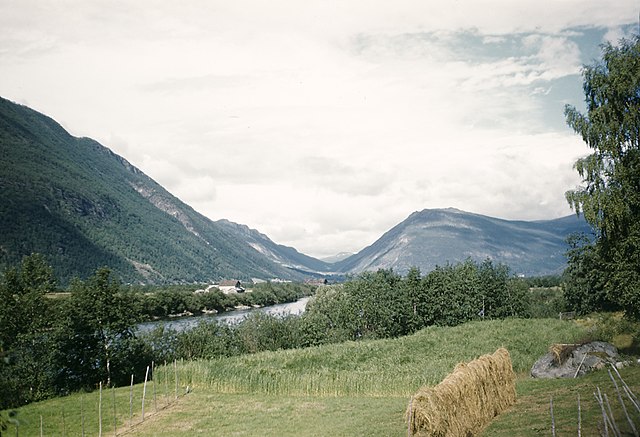
Gudbrandsdalen Valley in Norway. Gudbrandsdalen i Norge. Location: Gudbrandsdalen, Oppland fylke (county), Norway Photograph by: Fredrik Bruno Date: 24.07.1948 Format: Colour slide Persistent URL: kmb.raa.se/cocoon/bild/show-image.html?id=16001000281484 Read more about the photo database (in english): www.kms.raa.se/cocoon/bild/about.html |
||||||||||||||||||||||||||||||||||||||||||||||||
| Zdroj | Gudbrandsdalen Valley, Oppland, Norway | ||||||||||||||||||||||||||||||||||||||||||||||||
| Autor |
|
||||||||||||||||||||||||||||||||||||||||||||||||
| Svolení (Užití tohoto souboru) |
Swedish National Heritage Board @ Flickr Commons | ||||||||||||||||||||||||||||||||||||||||||||||||

.jpg)
| Pozice fotografa | | Tento snímek a mnohé další na: OpenStreetMap |
|---|
.jpg¶ms=061.566208_N_0009.634323_E_globe:Earth_type:camera_source:Flickr_&language=cs)
Licence
This image was taken from Flickr's The Commons. The uploading organization may have various reasons for determining that no known copyright restrictions exist, such as:
More information can be found at https://flickr.com/commons/usage/. Please add additional copyright tags to this image if more specific information about copyright status can be determined. See Commons:Licensing for more information. |
| Tento obrázek, který byl původně zveřejněn na Flickru, zkontroloval 21. září 2013 správce nebo kontrolor File Upload Bot (Magnus Manske) a potvrdil, že je na Flickru dostupný pod správnou licencí. |
Historie souboru
Kliknutím na datum a čas se zobrazí tehdejší verze souboru.
| Datum a čas | Náhled | Rozměry | Uživatel | Komentář | |
|---|---|---|---|---|---|
| současná | 21. 9. 2013, 17:54 | | 1 024 × 700 (263 KB) | File Upload Bot (Magnus Manske) | Transferred from Flickr by User:russavia |
Využití souboru
Tento soubor používá následující stránka:
Globální využití souboru
Tento soubor využívají následující wiki:
- Využití na ca.wikipedia.org
- Využití na en.wikipedia.org
- Využití na eo.wikipedia.org
- Využití na es.wikipedia.org
- Využití na fi.wikipedia.org
- Využití na fr.wikipedia.org
- Využití na fr.wikivoyage.org
- Využití na he.wikipedia.org
- Využití na hu.wikipedia.org
- Využití na hy.wikipedia.org
- Využití na ka.wikipedia.org
- Využití na mt.wikipedia.org
- Využití na nn.wikipedia.org
- Využití na os.wikipedia.org
- Využití na pl.wikipedia.org
- Využití na ro.wikipedia.org
- Využití na ru.wikipedia.org
- Využití na sr.wikipedia.org
- Využití na sv.wikipedia.org
- Využití na www.wikidata.org
.jpg)