Soubor:Forum-Romanum-Platner.jpg
Původní soubor (1 400 × 1 037 pixelů, velikost souboru: 657 KB, MIME typ: image/jpeg)
| Tento soubor pochází z Wikimedia Commons. Níže jsou zobrazeny informace, které obsahuje jeho tamější stránka s popisem souboru. |
Popis
| Popis |
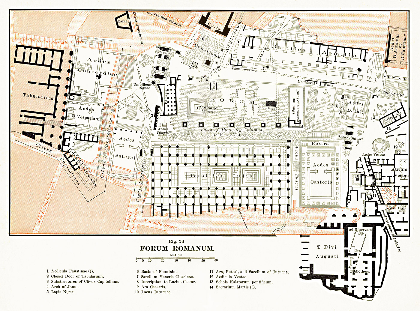
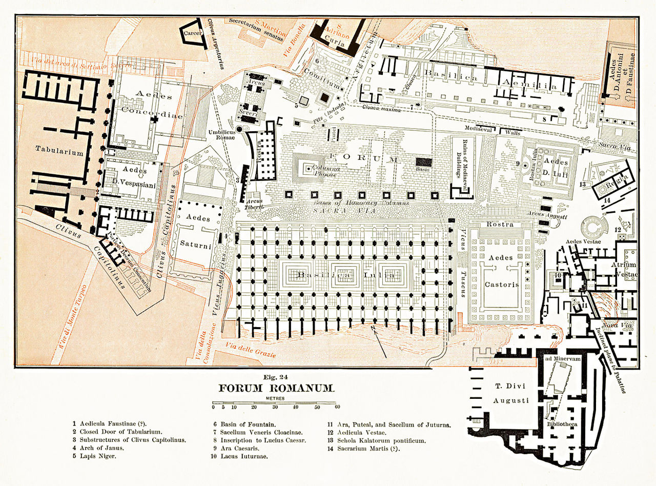
English: Map of the Roman Forum area. The scan from the original book was edited and corrected.
Français : Carte de la zone du Forum Romain à Rome (Latium, Italie).
Italiano: Pianta archeologica del Foro Romano, modificata da una scansione su due pagine del libro "The Topography and Monuments of Ancient Rome" di Ball Platner edito nel 1904. |
| Datum | |
| Zdroj | Samuel Ball Platner's The Topography and Monuments of Ancient Rome (1904) |
| Autor | saikindi |
Licence
|
Toto dílo je volné také v zemích, jejichž právní řád chrání majetková autorská práva po dobu života autora a 70 let po jeho smrti.
| |
| Bylo zjištěno, že u tohoto souboru nejsou známa žádná omezení daná autorským právem a právy s ním souvisejícími. | |
Historie souboru
Kliknutím na datum a čas se zobrazí tehdejší verze souboru.
| Datum a čas | Náhled | Rozměry | Uživatel | Komentář | |
|---|---|---|---|---|---|
| současná | 17. 9. 2009, 17:45 | | 1 400 × 1 037 (657 KB) | Saikindi | {{Information |Description={{en|1=Map of the Roman Forum area. The scan from the original book was edited and corrected.}} {{it|1=Pianta archeologica del Foro Romano, modificata da una scansione su due pagine del libro "The Topography and Monuments of Anc |
Využití souboru
Tento soubor používá následující stránka:
Globální využití souboru
Tento soubor využívají následující wiki:
- Využití na bg.wikipedia.org
- Využití na el.wikipedia.org
- Využití na fr.wikipedia.org
- Využití na it.wikipedia.org
- Využití na ja.wikipedia.org
- Využití na ru.wikipedia.org