Soubor:Fort Peck Dam (Fort Peck Montana) 1986 01.jpg
Velikost tohoto náhledu: 800 × 397 pixelů. Jiná rozlišení: 320 × 159 pixelů | 640 × 317 pixelů | 1 397 × 693 pixelů.
Původní soubor (1 397 × 693 pixelů, velikost souboru: 778 KB, MIME typ: image/jpeg)
| Tento soubor pochází z Wikimedia Commons. Níže jsou zobrazeny informace, které obsahuje jeho tamější stránka s popisem souboru. |
_1986_01.jpg)
|
This is an image of a place or building that is listed on the National Register of Historic Places in the United States of America. Its reference number is 86002061. |
Popis
| Popis |
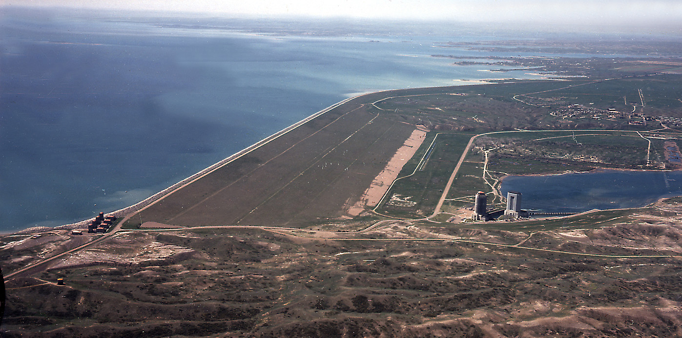
English: Aerial view of Fort Peck Dam, showing both powerhouses and dam. Missouri River, Fort Peck, Montana. |
|||
| Umístění | Fort Peck, Montana, USA 48°0′9.21″N 106°25′32.13″W / 48.0025583°N 106.4255917°W |
|||
| Datum | ||||
| Zdroj | U.S. Army Corps of Engineers, Digital Visual Library | |||
| Autor | US Army Corps of Engineers, Photographed by Robert Etzel | |||
| Svolení (Užití tohoto souboru) |
|
_1986_01.jpg¶ms=48_0_9.21_N_106_25_32.13_W_type:city)
| Pozice objektu | | Tento snímek a mnohé další na: OpenStreetMap |
|---|
_1986_01.jpg¶ms=048.004722_N_-106.419444_E_globe:Earth_class:object_region:US_type:landmark_scale:1500_&language=cs)
Historie souboru
Kliknutím na datum a čas se zobrazí tehdejší verze souboru.
| Datum a čas | Náhled | Rozměry | Uživatel | Komentář | |
|---|---|---|---|---|---|
| současná | 9. 2. 2007, 18:52 | | 1 397 × 693 (778 KB) | Ltvine | == Summary == {{Information |Description= Aerial view of Fort Peck Dam, showing both powerhouses and dam. Missouri River, Fort Peck, Montana. |Source=[http://images.usace.army.mil/ U.S. Army Corps of Engineers, Digital Visual Library] |Date=1986 |Author= |
Využití souboru
Tento soubor používá následující stránka:
Globální využití souboru
Tento soubor využívají následující wiki:
- Využití na ast.wikipedia.org
- Využití na de.wikipedia.org
- Využití na en.wikipedia.org
- Využití na es.wikipedia.org
- Využití na fr.wikipedia.org
- Využití na fr.wikivoyage.org
- Využití na gl.wikipedia.org
- Využití na hr.wikipedia.org
- Využití na it.wikipedia.org
- Využití na ja.wikipedia.org
- Využití na lt.wikipedia.org
- Využití na ml.wikipedia.org
- Využití na no.wikipedia.org
- Využití na pt.wikipedia.org
- Využití na ru.wikipedia.org
- Využití na ta.wikipedia.org
- Využití na uk.wikipedia.org
- Využití na www.wikidata.org
_1986_01.jpg)