Soubor:Basse-Normandie region relief location map.jpg

Velikost tohoto náhledu: 740 × 600 pixelů. Jiná rozlišení: 296 × 240 pixelů | 592 × 480 pixelů | 948 × 768 pixelů | 1 264 × 1 024 pixelů | 1 414 × 1 146 pixelů.
Původní soubor (1 414 × 1 146 pixelů, velikost souboru: 309 KB, MIME typ: image/jpeg)
| Tento soubor pochází z Wikimedia Commons. Níže jsou zobrazeny informace, které obsahuje jeho tamější stránka s popisem souboru. |
Popis
| Pozice fotografa | | Tento snímek a mnohé další na: OpenStreetMap |
|---|
| Popis |
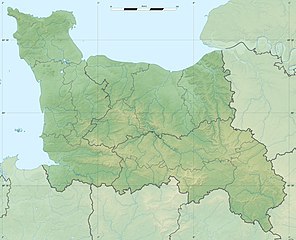
English: Blank physical map of the region of Lower Normandy, France, for geo-location purpose, with distinct boundaries for regions, departments and arrondissements.
Français : Carte physique vierge de la région de Basse-Normandie, France, destinée à la géolocalisation, avec limite distincte des régions, départements et arrondissements. Scales:
Equirectangular projection, WGS84 datum
Geographic limits of the map:
|
||
| Datum | |||
| Zdroj |
Vlastní dílo
|
||
| Autor | Eric Gaba (Sting - fr:Sting) | ||
| Svolení (Užití tohoto souboru) |
|
||
| Další verze |
|

Licence
Já, držitel autorských práv k tomuto dílu, ho tímto zveřejňuji za podmínek následujících licencí:
Tento soubor podléhá licenci Creative Commons Uveďte autora-Zachovejte licenci 3.0 Unported
- Dílo smíte:
- šířit – kopírovat, distribuovat a sdělovat veřejnosti
- upravovat – pozměňovat, doplňovat, využívat celé nebo částečně v jiných dílech
- Za těchto podmínek:
- uveďte autora – Máte povinnost uvést autorství, poskytnout odkaz na licenci a uvést, pokud jste provedli změny. Toho můžete docílit jakýmkoli rozumným způsobem, avšak ne způsobem naznačujícím, že by poskytovatel licence schvaloval nebo podporoval vás nebo vaše užití díla.
- zachovejte licenci – Pokud tento materiál jakkoliv upravíte, přepracujete nebo použijete ve svém díle, musíte své příspěvky šířit pod stejnou nebo slučitelnou licencí jako originál.

|
Tento dokument smí být kopírován, šířen nebo upravován podle podmínek Svobodné licence GNU pro dokumenty verze 1.2 nebo libovolné vyšší verze publikované nadací Free Software Foundation. Dokument nemá neměnné části ani texty na předním či zadním přebalu. Kopie textu licence je k dispozici v oddíle nazvaném GNU Free Documentation License. |
Můžete si zvolit libovolnou z těchto licencí.
Historie souboru
Kliknutím na datum a čas se zobrazí tehdejší verze souboru.
| Datum a čas | Náhled | Rozměry | Uživatel | Komentář | |
|---|---|---|---|---|---|
| současná | 18. 7. 2010, 23:09 | | 1 414 × 1 146 (309 KB) | Sting | Color profile |
| 17. 1. 2010, 02:52 |  | 1 414 × 1 146 (321 KB) | Sting | == {{int:filedesc}} == {{Location|48|57|00|N|00|28|30|W|scale:500000}} <br/> {{Information |Description={{en|Blank physical map of the region of Lower Normandy, France, for geo-location purpose, with distinct boundaries for regions, |
Využití souboru
Tento soubor používá následující stránka:
Globální využití souboru
Tento soubor využívají následující wiki:
- Využití na ar.wikipedia.org
- Využití na bg.wikipedia.org
- Využití na ca.wikipedia.org
- Využití na ceb.wikipedia.org
- Využití na ce.wikipedia.org
- Využití na de.wikipedia.org
- Využití na el.wikipedia.org
- Využití na en.wikipedia.org
- Využití na eo.wikipedia.org
- Využití na es.wikipedia.org
- Využití na fa.wikipedia.org
- Využití na fo.wikipedia.org
- Využití na fr.wikipedia.org
- Bataille de Tinchebray
- Bataille de Normandie
- Utah Beach
- Sword Beach
- Gold Beach
- Juno Beach
- Bataille de Caen
- Opération Epsom
- Bataille de Formigny
- Débarquement de Normandie
- Cap de Carteret
- Siège de Granville
- Opération Bluecoat
- Bataille de Villers-Bocage
- Opération Spring
- Opération Totalize
- Forêt de Saint-Sever
- Abbaye Notre-Dame de la Trappe
- Opération Perch
- Bataille de Carentan
- Opération Tractable
Zobrazit další globální využití tohoto souboru.