Soubor:Bas-Rhin department relief location map.jpg

Velikost tohoto náhledu: 538 × 600 pixelů. Jiná rozlišení: 215 × 240 pixelů | 431 × 480 pixelů | 689 × 768 pixelů | 1 047 × 1 167 pixelů.
Původní soubor (1 047 × 1 167 pixelů, velikost souboru: 347 KB, MIME typ: image/jpeg)
| Tento soubor pochází z Wikimedia Commons. Níže jsou zobrazeny informace, které obsahuje jeho tamější stránka s popisem souboru. |
Popis
| Pozice fotografa | | Tento snímek a mnohé další na: OpenStreetMap |
|---|
| Popis |
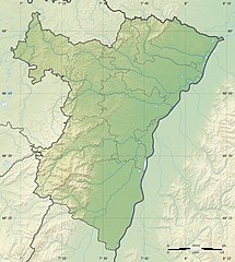
Topographic scale: 1:400,000 (precision: 100 m)
Geographic limits of the map:
|
||
| Datum | |||
| Zdroj |
Vlastní dílo
|
||
| Autor | Eric Gaba (Sting - fr:Sting) | ||
| Svolení (Užití tohoto souboru) |
|
||
| Další verze |
|

Licence
Já, držitel autorských práv k tomuto dílu, ho tímto zveřejňuji za podmínek následujících licencí:
Tento soubor podléhá licenci Creative Commons Uveďte autora-Zachovejte licenci 3.0 Unported
- Dílo smíte:
- šířit – kopírovat, distribuovat a sdělovat veřejnosti
- upravovat – pozměňovat, doplňovat, využívat celé nebo částečně v jiných dílech
- Za těchto podmínek:
- uveďte autora – Máte povinnost uvést autorství, poskytnout odkaz na licenci a uvést, pokud jste provedli změny. Toho můžete docílit jakýmkoli rozumným způsobem, avšak ne způsobem naznačujícím, že by poskytovatel licence schvaloval nebo podporoval vás nebo vaše užití díla.
- zachovejte licenci – Pokud tento materiál jakkoliv upravíte, přepracujete nebo použijete ve svém díle, musíte své příspěvky šířit pod stejnou nebo slučitelnou licencí jako originál.

|
Tento dokument smí být kopírován, šířen nebo upravován podle podmínek Svobodné licence GNU pro dokumenty verze 1.2 nebo libovolné vyšší verze publikované nadací Free Software Foundation. Dokument nemá neměnné části ani texty na předním či zadním přebalu. Kopie textu licence je k dispozici v oddíle nazvaném GNU Free Documentation License. |
Můžete si zvolit libovolnou z těchto licencí.
Historie souboru
Kliknutím na datum a čas se zobrazí tehdejší verze souboru.
| Datum a čas | Náhled | Rozměry | Uživatel | Komentář | |
|---|---|---|---|---|---|
| současná | 18. 7. 2010, 23:03 | | 1 047 × 1 167 (347 KB) | Sting | Color profile |
| 28. 4. 2009, 21:56 |  | 1 047 × 1 167 (312 KB) | Sting | == Summary == {{Location|48|36|00|N|07|35|15|E|scale:500000}} <br/> {{Information |Description={{en|Blank physical map of the department of Bas-Rhin, France, for geo-location purpose.}} {{fr|Ca |
Využití souboru
Tento soubor používá následující stránka:
Globální využití souboru
Tento soubor využívají následující wiki:
- Využití na als.wikipedia.org
- Využití na de.wikipedia.org
- Odilienberg
- Donon
- Hohkönigsburg
- Zaberner Steige
- Burg Fleckenstein
- Hohenburg (Elsass)
- Burg Altwindstein
- Frönsburg
- Wasenburg
- Burgruine Löwenstein
- Burg Klein-Arnsberg
- Burg Hohbarr
- Altenberg (Bas-Rhin)
- Oedenburg (Elsass)
- Burg Nideck
- Burg Kintzheim
- Burg Ortenberg (Elsass)
- Burg Hoh-Andlau
- Spesburg
- Wikipedia:Kartenwerkstatt/Positionskarten/Europa
- Burg Ramstein (Elsass)
- Burg Kochersberg
- Climont
- Champ du Feu
- Grand Wintersberg
- Rocher de Mutzig
- Vorlage:Positionskarte Frankreich Bas-Rhin
- Hüneburg (Elsass)
- Mont Saint-Michel (Vogesen)
- Tunnel de Saverne
- Burg Bernstein (Elsass)
- Schlossberg (Vogesen)
- Sender Nordheim
- Ungersberg
- Heidenkopf (Vogesen)
- Brotschberg
- Wasenkoepfel
- Scherhol
- Kraftwerk Marckolsheim
- Kraftwerk Rhinau
- Kraftwerk Gerstheim
- Kraftwerk Straßburg
- Sender Straßburg (Rheinhafen)
- Schneeberg (Vogesen)
- Mohnenberg
- Burg Rathsamhausen
- Lützelburg (Ottrott)
Zobrazit další globální využití tohoto souboru.