Soubor:Assab volcanic field.jpg
Větší rozlišení není k dispozici
Assab_volcanic_field.jpg (635 × 480 pixelů, velikost souboru: 71 KB, MIME typ: image/jpeg)
| Tento soubor pochází z Wikimedia Commons. Níže jsou zobrazeny informace, které obsahuje jeho tamější stránka s popisem souboru. |
Popis
| Popis |
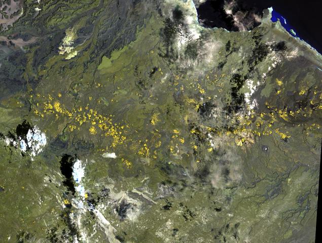
English: The long chain of pyroclastic cones and lava flows extending East-West across this Landsat image is the Assab volcanic field near the Red Sea coast in southern Eritrea.
|
| Datum | |
| Zdroj | http://www.volcano.si.edu/world/volcano.cfm?vnum=0201-125&volpage=photos&photo=111076 |
| Autor | NASA Landsat image (courtesy of Hawaii Synergy Project, Univ. of Hawaii Institute of Geophysics & Planetology) |
Licence
| This file is in the public domain in the United States because it was solely created by NASA. NASA copyright policy states that "NASA material is not protected by copyright unless noted". (See Template:PD-USGov, NASA copyright policy page or JPL Image Use Policy.) | ||
 |
Warnings:
|
Historie souboru
Kliknutím na datum a čas se zobrazí tehdejší verze souboru.
| Datum a čas | Náhled | Rozměry | Uživatel | Komentář | |
|---|---|---|---|---|---|
| současná | 30. 10. 2010, 15:51 | | 635 × 480 (71 KB) | Michael Metzger | {{Information |Description={{en|1=The long chain of pyroclastic cones and lava flows extending East-West across this Landsat image is the Assab volcanic field near the Red Sea coast in southern Eritrea. This spectacular range of basaltic cinder cones and |
Využití souboru
Tento soubor používá následující stránka:
Globální využití souboru
Tento soubor využívají následující wiki:
- Využití na ar.wikipedia.org
- Využití na bn.wikipedia.org
- Využití na ca.wikipedia.org
- Využití na de.wikipedia.org
- Využití na en.wikipedia.org
- Využití na fa.wikipedia.org
- Využití na fr.wikipedia.org
- Využití na lld.wikipedia.org
- Využití na ro.wikipedia.org
- Využití na ru.wikipedia.org
- Využití na sk.wikipedia.org
- Využití na uk.wikipedia.org
- Využití na www.wikidata.org