Soubor:Amboy Crater Area of Critical Environmental Concern, California (15665575311).jpg

Původní soubor (2 048 × 1 365 pixelů, velikost souboru: 1,58 MB, MIME typ: image/jpeg)
| Tento soubor pochází z Wikimedia Commons. Níže jsou zobrazeny informace, které obsahuje jeho tamější stránka s popisem souboru. |
.jpg)
Popis
| Popis |
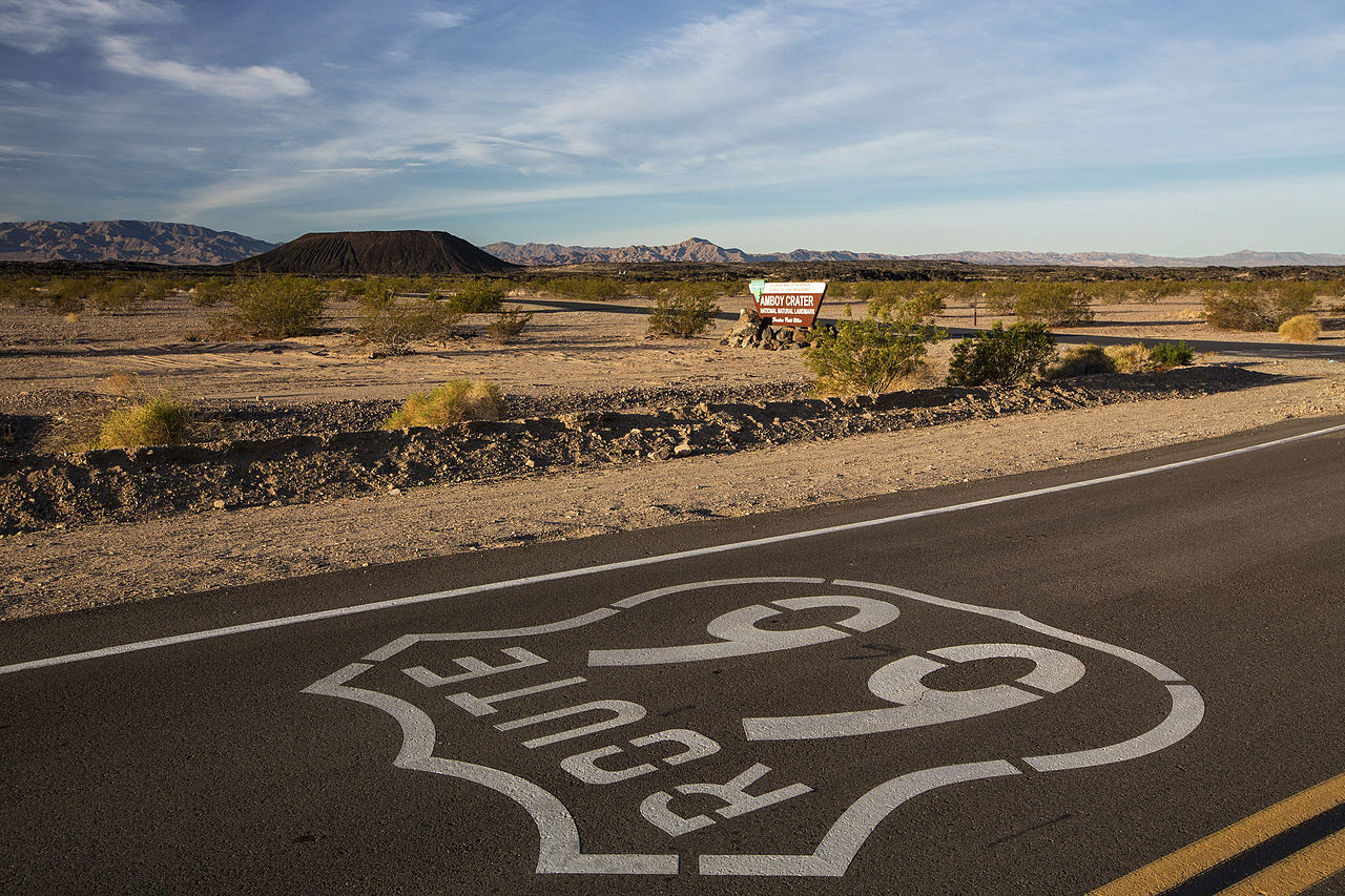
Amboy Crater Area of Critical Environmental Concern (ACEC) is an extinct cinder cone located just off of historic Route 66 between Barstow and Needles - the area was bypassed by Interstate 40 in the early ’70s. Before then, especially from the end of WWII through the ’60s, it was a major attraction along this Main Street of America, and many visitors would “get their kicks” by climbing Amboy Crater so they could brag about conquering a real volcano. After the climb, visitors would head to Roy’s Cafe in the nearby town of Amboy, just a few miles away, to have a cold drink or a meal. Roy’s once employed 70 people and was a bustling stop for travelers. Luckily the current owner is interested in preserving this piece of Americana. Through BLM’s public planning process, Amboy Crater was recognized as an ACEC for its visual and geological significance. The inside of the 250’ high crater contains two lava dams behind which has formed small lava lakes. These appear flat, covered with light colored clay, creating the impression of miniature “dry lakes.” There is a breach on the west side of the crater where basaltic lava poured out over a vast area. Beyond the crater lies 24 square miles of lava flow containing such features as lava lakes, collapsed lava tubes and sinks, spatter cones and massive flows of basalt. The unique landscapes found at Amboy Crater have attracted the filming and research industry - and enthusiastic visitors have followed. Like many ACECs, the Amboy Crater provides breathtaking views, great outdoor recreation opportunities and a slice of American history. -Photos by Bob Wick, BLM |
| Datum | |
| Zdroj | Amboy Crater Area of Critical Environmental Concern, California |
| Autor | Bureau of Land Management |
Licence
- Dílo smíte:
- šířit – kopírovat, distribuovat a sdělovat veřejnosti
- upravovat – pozměňovat, doplňovat, využívat celé nebo částečně v jiných dílech
- Za těchto podmínek:
- uveďte autora – Máte povinnost uvést autorství, poskytnout odkaz na licenci a uvést, pokud jste provedli změny. Toho můžete docílit jakýmkoli rozumným způsobem, avšak ne způsobem naznačujícím, že by poskytovatel licence schvaloval nebo podporoval vás nebo vaše užití díla.
| This image was originally posted to Flickr by mypubliclands at https://flickr.com/photos/91981596@N06/15665575311. It was reviewed on 4. srpna 2015 by FlickreviewR and was confirmed to be licensed under the terms of the cc-by-2.0. |
| This image is a work of a Bureau of Land Management* employee, taken or made as part of that person's official duties. As a work of the U.S. federal government, the image is in the public domain in the United States. *or predecessor organization |
Historie souboru
Kliknutím na datum a čas se zobrazí tehdejší verze souboru.
| Datum a čas | Náhled | Rozměry | Uživatel | Komentář | |
|---|---|---|---|---|---|
| současná | 4. 8. 2015, 21:33 | | 2 048 × 1 365 (1,58 MB) | Wilfredor | Transferred from Flickr via Flickr2Commons |
Využití souboru
Tento soubor používá následující stránka:
.jpg)