Soubor:Africa-countries-northern.png
Větší rozlišení není k dispozici
Africa-countries-northern.png (360 × 392 pixelů, velikost souboru: 10 KB, MIME typ: image/png)
| Tento soubor pochází z Wikimedia Commons. Níže jsou zobrazeny informace, které obsahuje jeho tamější stránka s popisem souboru. |

|
K tomuto obrázku existuje vektorová verze (v SVG). Pokud je lepší, používejte raději tu.
File:Africa-countries-northern.png → File:Africa-countries-northern.svg
Podrobnější informace o vektorové grafice najdete na stránce Commons:Transition to SVG. Také si můžete přečíst informace o podpoře formátu SVG v MediaWiki. |
 |
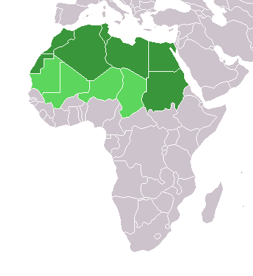
Popis
English: Map of countries in geo-political North Africa — as considered by the U.N.
- Credits
from en:Image:Africa-countries-northern.png

|
Tento dokument smí být kopírován, šířen nebo upravován podle podmínek Svobodné licence GNU pro dokumenty verze 1.2 nebo libovolné vyšší verze publikované nadací Free Software Foundation. Dokument nemá neměnné části ani texty na předním či zadním přebalu. Kopie textu licence je k dispozici v oddíle nazvaném GNU Free Documentation License. |
| Tento soubor podléhá licenci Creative Commons Uveďte autora-Zachovejte licenci 3.0 Unported. | ||
| ||
| Tato licenční šablona byla k tomuto souboru přidána v rámci změny licencování. |
Historie souboru
Kliknutím na datum a čas se zobrazí tehdejší verze souboru.
| Datum a čas | Náhled | Rozměry | Uživatel | Komentář | |
|---|---|---|---|---|---|
| současná | 17. 3. 2018, 17:22 | | 360 × 392 (10 KB) | Maphobbyist | Montenegro border |
| 31. 3. 2016, 23:00 |  | 360 × 392 (10 KB) | Fry1989 | Reverted to version as of 16:12, 13 January 2014 (UTC) | |
| 7. 11. 2015, 11:37 |  | 360 × 392 (10 KB) | Hpyounes | correction | |
| 13. 1. 2014, 18:12 |  | 360 × 392 (10 KB) | VVVF | See http://unstats.un.org/unsd/methods/m49/m49regin.htm | |
| 13. 1. 2014, 17:59 |  | 360 × 392 (13 KB) | VVVF | Reverted to version as of 20:15, 9 July 2011. See http://unstats.un.org/unsd/methods/m49/m49regin.htm | |
| 20. 7. 2011, 14:47 |  | 360 × 392 (7 KB) | Kahusi | See http://unstats.un.org/unsd/methods/m49/m49regin.htm | |
| 9. 7. 2011, 22:15 |  | 360 × 392 (13 KB) | Maphobbyist | South Sudan has become independent on July 9, 2011. Sudan and South Sudan are shown with the new international border between them. | |
| 5. 5. 2006, 13:13 |  | 360 × 392 (4 KB) | Hautala | optimized with png | |
| 20. 4. 2005, 18:30 |  | 360 × 392 (14 KB) | Yonghokim | map of countries in Northern Africa. from en:Image:Africa-countries-northern.png {{GFDL}} |
Využití souboru
Tento soubor nepoužívá žádná stránka.
Globální využití souboru
Tento soubor využívají následující wiki:
- Využití na ce.wikipedia.org
- Využití na es.wikipedia.org
- Využití na fr.wikipedia.org
- Využití na he.wikipedia.org
- Využití na ru.wikipedia.org
- Využití na sc.wikipedia.org
- Využití na sv.wikinews.org