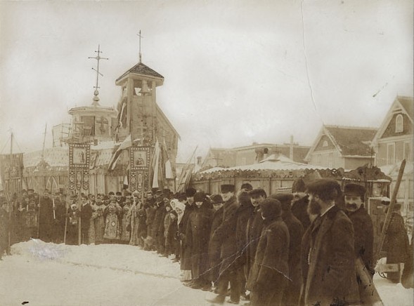
Soubor:Tin Can Cathedral.jpg
Tin_Can_Cathedral.jpg (589 × 436 pixelů, velikost souboru: 66 KB, MIME typ: image/jpeg)
| Tento soubor pochází z Wikimedia Commons. Níže jsou zobrazeny informace, které obsahuje jeho tamější stránka s popisem souboru. |
Popis
| Popis | ||||||||||||||||||||
| Datum | ||||||||||||||||||||
| Zdroj |
|
|||||||||||||||||||
| Autor |
|
|||||||||||||||||||
| Svolení (Užití tohoto souboru) |
|
|||||||||||||||||||

| Pozice fotografa | | Tento snímek a mnohé další na: OpenStreetMap |
|---|
Credit: Donald MacKenzie / Library and Archives Canada / e002344135
Licence
Toto kanadské dílo je v Kanadě volným dílem, protože jeho autorská práva vypršela z jednoho z následujících důvodů:
nebylo předmětem Crown copyright a
|
 |
Historie souboru
Kliknutím na datum a čas se zobrazí tehdejší verze souboru.
| Datum a čas | Náhled | Rozměry | Uživatel | Komentář | |
|---|---|---|---|---|---|
| současná | 13. 4. 2014, 00:48 | | 589 × 436 (66 KB) | Danmichaelo | Cropped 2 % horizontally and 3 % vertically using CropTool with precise mode. |
| 27. 5. 2012, 00:15 |  | 600 × 449 (86 KB) | Canoe1967 | ||
| 18. 5. 2012, 14:12 |  | 600 × 449 (86 KB) | Nicola Mitchell |
Využití souboru
Tento soubor používá následující stránka:
Globální využití souboru
Tento soubor využívají následující wiki:
- Využití na be.wikipedia.org
- Využití na bg.wikipedia.org
- Využití na bs.wikipedia.org
- Využití na da.wikipedia.org
- Využití na de.wikipedia.org
- Využití na el.wikipedia.org
- Využití na en.wikipedia.org
- Využití na eo.wikipedia.org
- Využití na es.wikipedia.org
- Využití na et.wikipedia.org
- Využití na fi.wikipedia.org
- Využití na fr.wikipedia.org
- Využití na gl.wikipedia.org
- Využití na hr.wikipedia.org
- Využití na hu.wikipedia.org
- Využití na is.wikipedia.org
- Využití na it.wikipedia.org
- Využití na ja.wikipedia.org
- Využití na ko.wikipedia.org
- Využití na lt.wikipedia.org
- Využití na lv.wikipedia.org
- Využití na mk.wikipedia.org
- Využití na nl.wikipedia.org
- Využití na no.wikipedia.org
- Využití na pl.wikipedia.org
- Využití na pt.wikipedia.org
- Využití na ro.wikipedia.org
- Využití na ru.wikipedia.org
- Využití na sk.wikipedia.org
- Využití na sl.wikipedia.org
- Využití na sr.wikipedia.org
- Využití na sv.wikipedia.org
- Využití na uk.wikipedia.org
- Využití na www.wikidata.org
- Využití na zh.wikipedia.org