Soubor:Plan de Paris 1705 BNF07710700.png
Velikost tohoto náhledu: 739 × 600 pixelů. Jiná rozlišení: 296 × 240 pixelů | 591 × 480 pixelů | 946 × 768 pixelů | 1 261 × 1 024 pixelů | 2 523 × 2 048 pixelů | 3 890 × 3 158 pixelů.
Původní soubor (3 890 × 3 158 pixelů, velikost souboru: 15,89 MB, MIME typ: image/png)
| Tento soubor pochází z Wikimedia Commons. Níže jsou zobrazeny informace, které obsahuje jeho tamější stránka s popisem souboru. |
Popis
| Autor |
|
||||||||||||||||||||
| Popis |
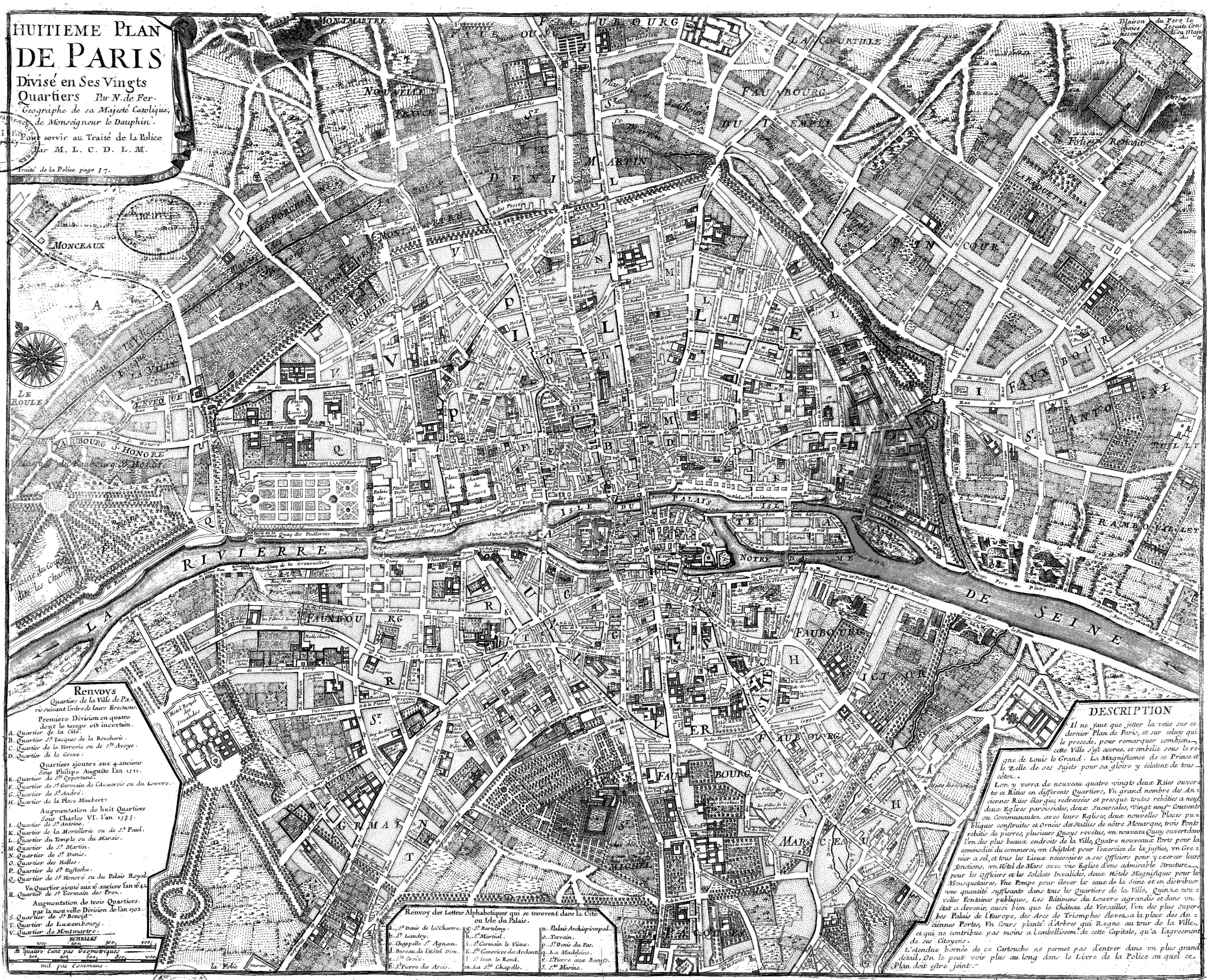
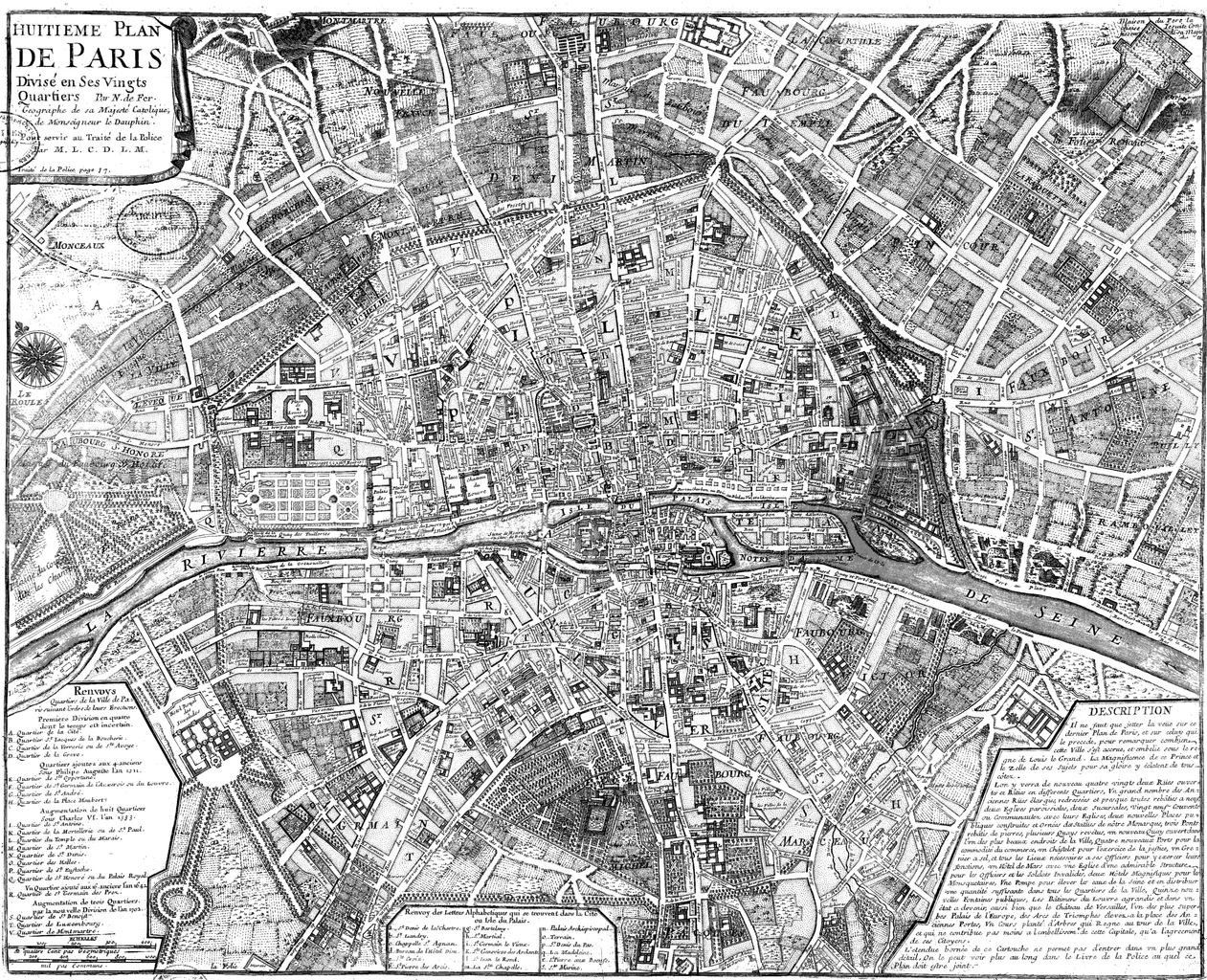
Français : Huitième plan de Paris divisé en ses vingts quartiers [Image fixe numérisée] / par N. de Fer Publication : Paris, 1705 Description matérielle : 1 carte ; 44,5 x 54,5 cm Collection : Collection d'Anville ; 00808 Note(s) : Cote : Ge DD 2987 (808) BNF Richelieu Cartes et Plans Reprod. 85 C 125661 ; Reprod. Sc 87/660 . - Légende et description en marge gauche et droite. Carte "pour servir au traité de la Police par M.L.C.D.L.M. Traité de la Police p. 87" Sujet(s) : Paris (France) -- Quartiers anciens Notice n° : FRBNF38638263 |
||||||||||||||||||||
| Datum | 1705 | ||||||||||||||||||||
| Zdroj/Fotograf | Gallica | ||||||||||||||||||||
| Další verze |
|
||||||||||||||||||||


| Open this image as an overlay in Google Earth (Google Maps, Bing) | (Help|Source) |
Licence
|
Toto dílo je volné také v zemích, jejichž právní řád chrání majetková autorská práva po dobu života autora a 100 let po jeho smrti. | |
| Bylo zjištěno, že u tohoto souboru nejsou známa žádná omezení daná autorským právem a právy s ním souvisejícími. | |
| Previous public domain rationale, no longer applicable | ||
|---|---|---|
|
Historie souboru
Kliknutím na datum a čas se zobrazí tehdejší verze souboru.
| Datum a čas | Náhled | Rozměry | Uživatel | Komentář | |
|---|---|---|---|---|---|
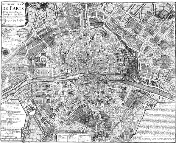
| současná | 9. 6. 2008, 11:20 | | 3 890 × 3 158 (15,89 MB) | Yann | reduce to below 12.5 Mpx, otherwise it will never display with Wikimedia limits. Nothing is lost (see history for the complete version, or the reference link) |
| 22. 9. 2005, 22:47 |  | 4 183 × 3 396 (2,76 MB) | David.Monniaux | Map of Paris in 1705 Type : image fixe, monographie Titre(s) : Huitième plan de Paris divisé en ses vingts quartiers [Image fixe numérisée] / par N. de Fer Publication : Paris, 1705 Description matérielle : 1 carte ; 44,5 x 54,5 cm Colle |
Využití souboru
Tento soubor nepoužívá žádná stránka.
Globální využití souboru
Tento soubor využívají následující wiki:
- Využití na ar.wikipedia.org
- Využití na en.wikipedia.org
- Využití na fr.wikipedia.org
- Využití na gl.wikipedia.org
- Využití na he.wikipedia.org
- Využití na hu.wikipedia.org
- Využití na it.wikipedia.org
- Využití na ja.wikipedia.org
- Využití na ko.wikipedia.org
- Využití na nl.wikipedia.org
- Využití na pl.wikipedia.org
- Využití na pnb.wikipedia.org
- Využití na ur.wikipedia.org