Soubor:La Palma LANDSAT-Canary Islands.png

Velikost tohoto náhledu: 800 × 549 pixelů. Jiná rozlišení: 320 × 219 pixelů | 640 × 439 pixelů | 1 022 × 701 pixelů.
Původní soubor (1 022 × 701 pixelů, velikost souboru: 1,04 MB, MIME typ: image/png)
| Tento soubor pochází z Wikimedia Commons. Níže jsou zobrazeny informace, které obsahuje jeho tamější stránka s popisem souboru. |
| Popis |
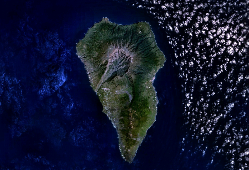
English: La Palma Island (Canary Islands, Spain) from LANDSAT7 satellite of NASA.
Español: Isla de La Palma (Islas Canarias, España) desde el satélite LANDSAT7 de la NASA.
|
| Datum | neznámé datum |
| Zdroj | NASA's World Wind software (images provided by NASA) |
| Autor | NASA |
| This image is in the public domain because it is a screenshot from NASA’s globe software World Wind using a public domain layer, such as Blue Marble, MODIS, Landsat, SRTM, USGS or GLOBE.
|
 |
Historie souboru
Kliknutím na datum a čas se zobrazí tehdejší verze souboru.
| Datum a čas | Náhled | Rozměry | Uživatel | Komentář | |
|---|---|---|---|---|---|
| současná | 21. 9. 2007, 00:05 | | 1 022 × 701 (1,04 MB) | Pepelopex | {{Information |Description= {{en|La Palma Island (Canary Islands, Spain) from LANDSAT7 satellite of NASA. * Coordinates: -17.85514W 28.66873N}} {{es|Isla de La Palma (Islas Canarias, España) desde el satélite LANDSAT7 de la NASA. * Coordenadas: -17.8551 |
Využití souboru
Tento soubor používají následující 2 stránky:
Globální využití souboru
Tento soubor využívají následující wiki:
- Využití na af.wikipedia.org
- Využití na an.wikipedia.org
- Využití na ar.wikipedia.org
- Využití na de.wikipedia.org
- Využití na de.wiktionary.org
- Využití na el.wikipedia.org
- Využití na es.wikipedia.org
- Využití na es.wiktionary.org
- Využití na gl.wikipedia.org
- Využití na haw.wikipedia.org
- Využití na hu.wikipedia.org
- Využití na it.wikipedia.org
- Využití na nn.wikipedia.org
- Využití na no.wikipedia.org
- Využití na sc.wikipedia.org
- Využití na sr.wikipedia.org
- Využití na war.wikipedia.org
- Využití na zh.wikipedia.org