Soubor:Karte-Hohenzollern.png
Velikost tohoto náhledu: 782 × 600 pixelů. Jiná rozlišení: 313 × 240 pixelů | 626 × 480 pixelů | 1 002 × 768 pixelů | 1 274 × 977 pixelů.
Původní soubor (1 274 × 977 pixelů, velikost souboru: 59 KB, MIME typ: image/png)
| Tento soubor pochází z Wikimedia Commons. Níže jsou zobrazeny informace, které obsahuje jeho tamější stránka s popisem souboru. |
| Popis |
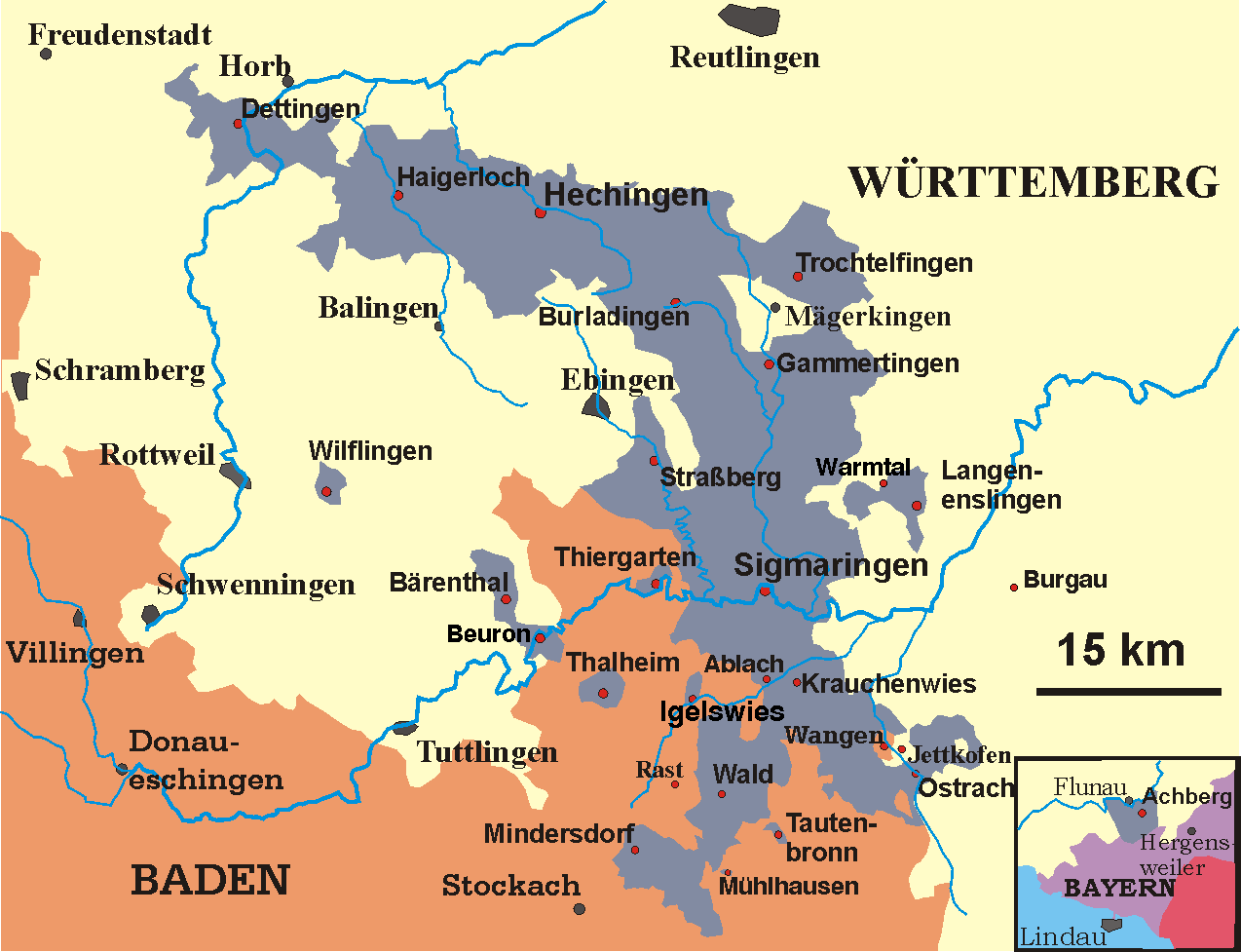
Deutsch: Karte der Hohenzollernschen Lande, Stand 1930
English: Map of the Prussian province of Hohenzollern, 1930 |
||
| Datum | May 2005-December 2006 | ||
| Zdroj | transferred from the German Wikipedia | ||
| Autor | Störfix (original author), Ssch (modifications) | ||
| Svolení (Užití tohoto souboru) |
|
Historie souboru
Kliknutím na datum a čas se zobrazí tehdejší verze souboru.
| Datum a čas | Náhled | Rozměry | Uživatel | Komentář | |
|---|---|---|---|---|---|
| současná | 1. 10. 2009, 08:37 | | 1 274 × 977 (59 KB) | Quartl | use brighter shade of blue to make texts better readable |
| 13. 2. 2007, 22:49 |  | 1 274 × 977 (61 KB) | Ssch~commonswiki | {{Information| |Description = de: Karte der Hohenzollernschen Lande, Stand 1930<br/> en: Map of the Prussian province of Hohenzollern, 1930 |Source = transferred from the German Wikipedia |Date = May 2005-December 2006 |Author = de:User:Störfix (ori |
Využití souboru
Tento soubor používají následující 2 stránky:
Globální využití souboru
Tento soubor využívají následující wiki:
- Využití na als.wikipedia.org
- Využití na ast.wikipedia.org
- Využití na azb.wikipedia.org
- Využití na be.wikipedia.org
- Využití na ca.wikipedia.org
- Využití na de.wikipedia.org
- Hohenzollern
- Hohenzollernsche Lande
- Sigmaringen
- Hechingen
- Wellendingen
- Achberg
- Hohenzollerische Landesbahn
- Schwäbische Hohenzollern
- Herrschaft Haigerloch
- Territoriale Besonderheiten in Südwestdeutschland nach 1810
- Wikipedia:Kartenwerkstatt/Archiv/2007-10
- Oberamt (Hohenzollern)
- Forschungsreaktor Haigerloch
- Thalheim (Leibertingen)
- Benutzer:QMRNMNN/Baustelle
- Využití na en.wikipedia.org
- Využití na eo.wikipedia.org
- Využití na es.wikipedia.org
- Využití na fi.wikipedia.org
- Využití na fr.wikipedia.org
- Využití na fr.wiktionary.org
- Využití na fy.wikipedia.org
- Využití na gl.wikipedia.org
- Využití na it.wikipedia.org
- Využití na la.wikipedia.org
- Využití na lt.wikipedia.org
- Využití na mk.wikipedia.org
- Využití na nl.wikipedia.org
- Využití na no.wikipedia.org
Zobrazit další globální využití tohoto souboru.