Soubor:Flathead County Montana Incorporated and Unincorporated areas Kalispell Highlighted.svg

Velikost tohoto PNG náhledu tohoto SVG souboru: 624 × 600 pixelů. Jiná rozlišení: 250 × 240 pixelů | 499 × 480 pixelů | 799 × 768 pixelů | 1 065 × 1 024 pixelů | 2 130 × 2 048 pixelů | 1 300 × 1 250 pixelů.
Původní soubor (soubor SVG, nominální rozměr: 1 300 × 1 250 pixelů, velikost souboru: 174 KB)
| Tento soubor pochází z Wikimedia Commons. Níže jsou zobrazeny informace, které obsahuje jeho tamější stránka s popisem souboru. |
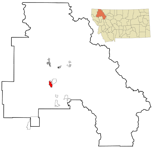
| Popis | This map shows the incorporated and unincorporated areas in Flathead County, Montana, highlighting Kalispell in red. It was created with a custom script with US Census Bureau data and modified with Inkscape. |
| Datum | |
| Zdroj | My own work, based on public domain information. Based on similar map concepts by Ixnayonthetimmay |
| Autor | Arkyan |
Já, držitel autorských práv k tomuto dílu, ho tímto zveřejňuji za podmínek následujících licencí:

|
Tento dokument smí být kopírován, šířen nebo upravován podle podmínek Svobodné licence GNU pro dokumenty verze 1.2 nebo libovolné vyšší verze publikované nadací Free Software Foundation. Dokument nemá neměnné části ani texty na předním či zadním přebalu. Kopie textu licence je k dispozici v oddíle nazvaném GNU Free Documentation License. |
| Tento soubor podléhá licenci Creative Commons Uveďte autora-Zachovejte licenci 3.0 Unported | ||
| ||
| Tato licenční šablona byla k tomuto souboru přidána v rámci změny licencování. |
Tento soubor podléhá licenci Creative Commons Uveďte autora-Zachovejte licenci 2.5 Generic, 2.0 Generic a 1.0 Generic.
- Dílo smíte:
- šířit – kopírovat, distribuovat a sdělovat veřejnosti
- upravovat – pozměňovat, doplňovat, využívat celé nebo částečně v jiných dílech
- Za těchto podmínek:
- uveďte autora – Máte povinnost uvést autorství, poskytnout odkaz na licenci a uvést, pokud jste provedli změny. Toho můžete docílit jakýmkoli rozumným způsobem, avšak ne způsobem naznačujícím, že by poskytovatel licence schvaloval nebo podporoval vás nebo vaše užití díla.
- zachovejte licenci – Pokud tento materiál jakkoliv upravíte, přepracujete nebo použijete ve svém díle, musíte své příspěvky šířit pod stejnou nebo slučitelnou licencí jako originál.
Můžete si zvolit libovolnou z těchto licencí.
Historie souboru
Kliknutím na datum a čas se zobrazí tehdejší verze souboru.
| Datum a čas | Náhled | Rozměry | Uživatel | Komentář | |
|---|---|---|---|---|---|
| současná | 25. 10. 2007, 00:20 | | 1 300 × 1 250 (174 KB) | ArkyBot~commonswiki | {{Information |Description=This map shows the incorporated and unincorporated areas in Flathead County, Montana, highlighting Kalispell in red. It was cre |
Využití souboru
Tento soubor používá následující stránka:
Globální využití souboru
Tento soubor využívají následující wiki:
- Využití na ar.wikipedia.org
- Využití na arz.wikipedia.org
- Využití na azb.wikipedia.org
- Využití na ca.wikipedia.org
- Využití na ceb.wikipedia.org
- Využití na cy.wikipedia.org
- Využití na de.wikipedia.org
- Využití na en.wikipedia.org
- Využití na eu.wikipedia.org
- Využití na fa.wikipedia.org
- Využití na fr.wikipedia.org
- Využití na ht.wikipedia.org
- Využití na hu.wikipedia.org
- Využití na it.wikipedia.org
- Využití na sh.wikipedia.org
- Využití na sr.wikipedia.org
- Využití na sv.wikipedia.org
- Využití na tr.wikipedia.org
- Využití na tt.wikipedia.org
- Využití na ur.wikipedia.org
- Využití na vo.wikipedia.org
- Využití na www.wikidata.org
- Využití na zh-min-nan.wikipedia.org
- Využití na zh.wikipedia.org