Soubor:Bouvet Island relief location map.svg

Velikost tohoto PNG náhledu tohoto SVG souboru: 791 × 600 pixelů. Jiná rozlišení: 317 × 240 pixelů | 633 × 480 pixelů | 1 013 × 768 pixelů | 1 280 × 971 pixelů | 2 560 × 1 942 pixelů | 1 693 × 1 284 pixelů.
Původní soubor (soubor SVG, nominální rozměr: 1 693 × 1 284 pixelů, velikost souboru: 699 KB)
| Tento soubor pochází z Wikimedia Commons. Níže jsou zobrazeny informace, které obsahuje jeho tamější stránka s popisem souboru. |
Popis
| Pozice fotografa | | Tento snímek a mnohé další na: OpenStreetMap |
|---|
| Popis |
Deutsch: Relief Positionskarte von Bouvetinsel
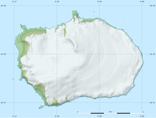
English: Blank relief location map of Bouvet Island
Français : Carte physique vierge de l’île Bouvet, destinée à la géolocalisation. Scale: 1:80,000 (precision: 20 m for the topography and ground features)
Geographic limits of the map:
|
|||||||||
| Datum | ||||||||||
| Zdroj | data: Norwegian Polar Institute (modified for the shaded relief) (under CC-BY 4.0) | |||||||||
| Autor | Eric Gaba (Sting - fr:Sting) | |||||||||
| Svolení (Užití tohoto souboru) |
|
|||||||||
| Další verze |
|
|||||||||

Licence
Já, držitel autorských práv k tomuto dílu, ho tímto zveřejňuji za podmínek následující licence:
Tento soubor podléhá licenci Creative Commons Uveďte autora-Zachovejte licenci 4.0 International
- Dílo smíte:
- šířit – kopírovat, distribuovat a sdělovat veřejnosti
- upravovat – pozměňovat, doplňovat, využívat celé nebo částečně v jiných dílech
- Za těchto podmínek:
- uveďte autora – Máte povinnost uvést autorství, poskytnout odkaz na licenci a uvést, pokud jste provedli změny. Toho můžete docílit jakýmkoli rozumným způsobem, avšak ne způsobem naznačujícím, že by poskytovatel licence schvaloval nebo podporoval vás nebo vaše užití díla.
- zachovejte licenci – Pokud tento materiál jakkoliv upravíte, přepracujete nebo použijete ve svém díle, musíte své příspěvky šířit pod stejnou nebo slučitelnou licencí jako originál.
Historie souboru
Kliknutím na datum a čas se zobrazí tehdejší verze souboru.
| Datum a čas | Náhled | Rozměry | Uživatel | Komentář | |
|---|---|---|---|---|---|
| současná | 17. 2. 2020, 23:45 | | 1 693 × 1 284 (699 KB) | Sting | == {{int:filedesc}} == {{Location|54|25|00|S|003|21|00|E|scale:100000}} {{Information |Description= {{de|Relief Positionskarte von Bouvetinsel}} {{en|Blank relief location map of Bouvet Island}} {{fr|Carte physique vierge de l’île Bouvet, destinée à la géolocalisation.}}<br/> Scale: 1:80,000 (precision: 20 m for the topography and ground features)<br/> Equirectangular projection, WGS84 datum<br/> *Standard meridian: 003.35835° E<br... |
Využití souboru
Tento soubor používá následující stránka:
Globální využití souboru
Tento soubor využívají následující wiki:
- Využití na de.wikipedia.org
- Kap Circoncision
- Benutzer:Carport/Bouvetøya
- Vorlage:Positionskarte Bouvetinsel
- Posadowsky-Gletscher (Bouvetinsel)
- Kap Fie
- Christensen-Gletscher (Bouvetinsel)
- Horntvedt-Gletscher
- Morrell-Riff
- Røverhullet
- Sachsebåane
- Morgenstierne-Küste
- Victoria-Terrasse-Küste
- Mowinckel-Küste
- Vogt-Küste
- Esmarch-Küste
- Engelbrecht-Gletscher
- Randibreen
- Slakhallet
- Westwindstranda
- Selstranda
- Sjøelefantstranda
- Svartstranda
- Smalstranda
- Aagaardbreen
- Kraterisen
- Selbadet
- Využití na en.wikipedia.org
- Využití na eo.wikipedia.org
- Využití na fr.wikipedia.org
- Využití na mn.wikipedia.org
- Využití na no.wikipedia.org
- Využití na si.wikipedia.org
- Využití na uz.wikipedia.org